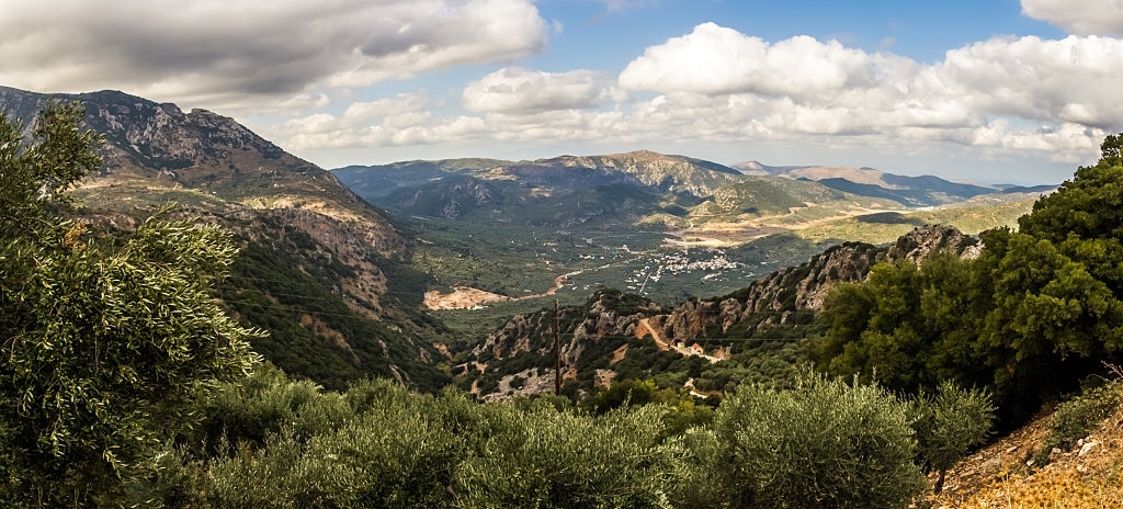
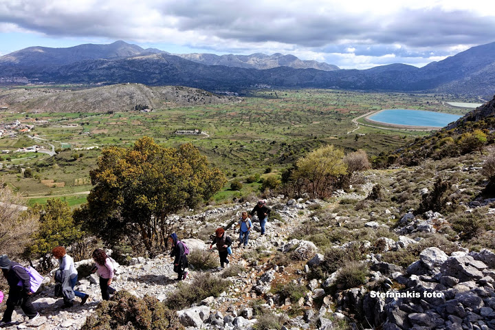
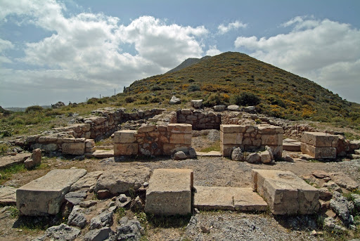
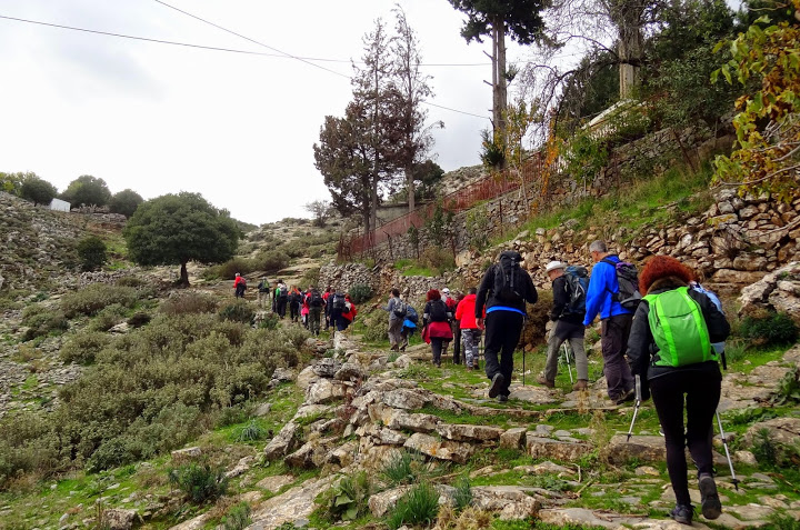
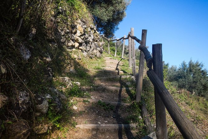
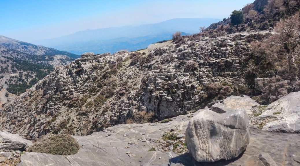
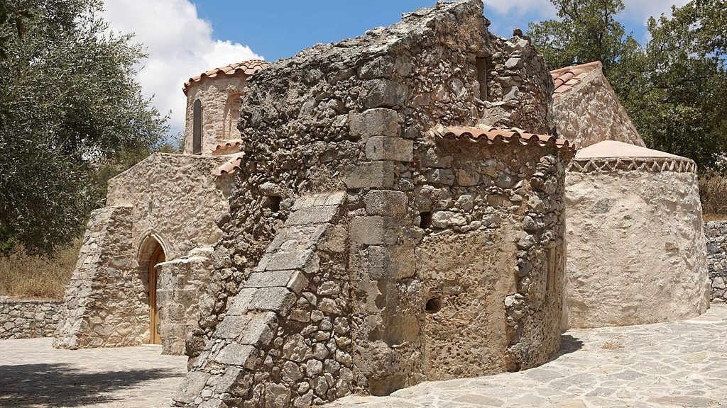
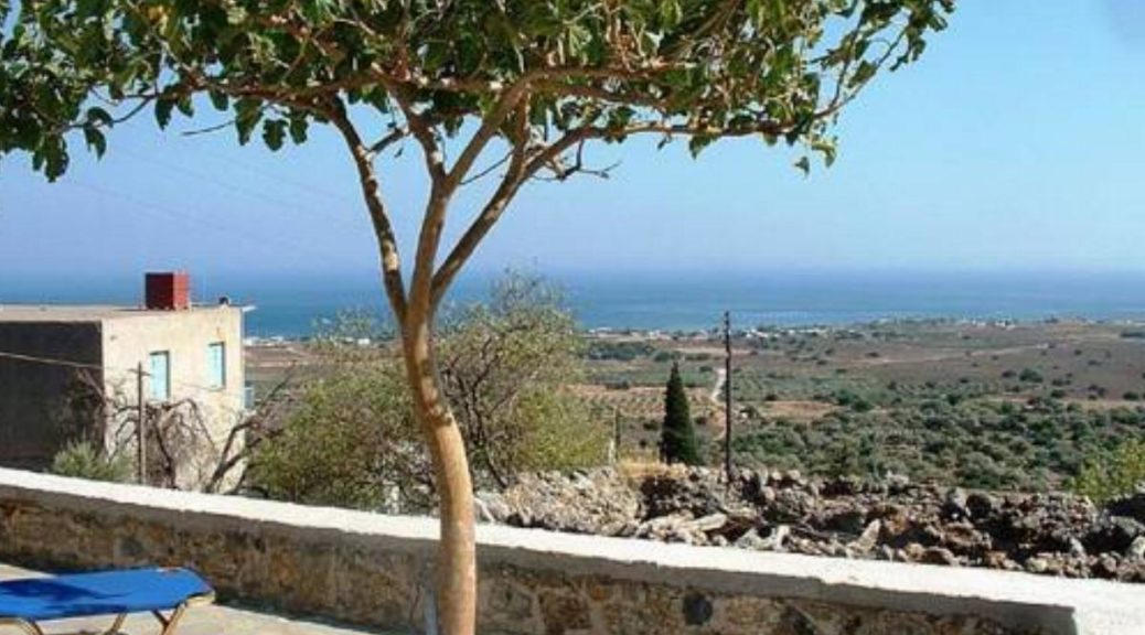
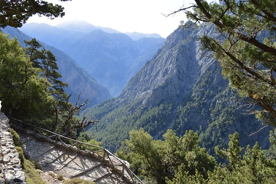
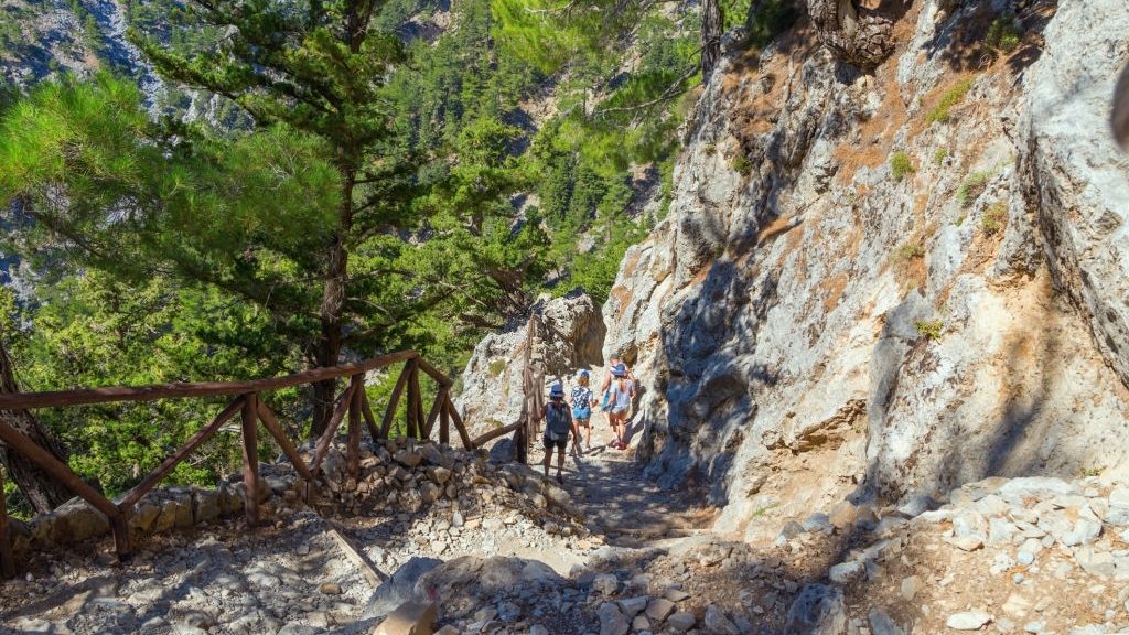
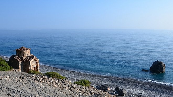
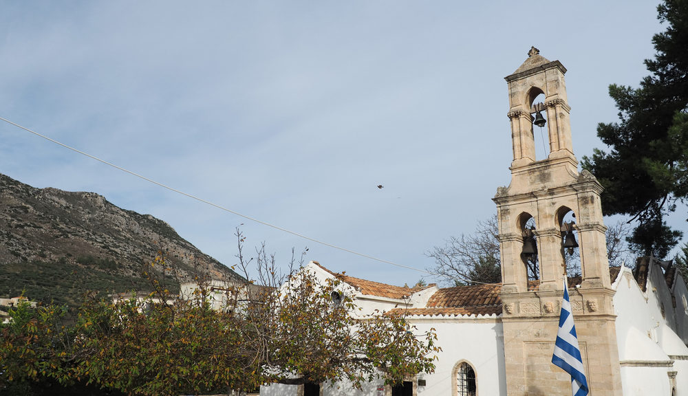
The part of the E4 European long-distance path that crosses through the Lassithi Prefecture is one of the least visited sections of the trail, yet offers incredible sights for visitors that seek the hidden treasures of Crete island. It crosses through the Lasithi plateau and various smaller ones like Limnakaro, Omalos Viannou and Katharo. The trail also passes through landscapes of rare beauty – such as the Selakano forest and runs on through the Ierapetra region and that of Makrygialos….
Read More Read More
The E4 trail that crosses through the island of Crete enters the Prefecture of Heraklion near the shelter of Timios Stavros (Holy Cross) on the peak of Psiloritis and travels down to the region of Akolyta – at which point it divides. The eastern branch follows the path to the Nida plateau and south to Kamares as it runs across the south and east flanks of Psiloritis into the hinterlands of the Prefecture. The natural environment varies, from the forest…
Read More Read More
The E4 trail in Rethymno consists of two sections – a northern and a southern. The first crosses the border from Chania at the village of Argyroupolis, the south in the area of Rodakino on the southern coast. The two parts meet up at the Nida plateau on Psiloritis mountain, the highest on the island. From there, the path goes on to enter the Heraklion Prefecture. Both branches cross areas of significant archaeological, historical and cultural worth. Depending on how…
Read More Read More
The E4 trail that crosses through the island of Crete starts in the prefecture of Chania at Kastelli Kissamos. It then travels from north to south to arrive at the Chrisoskalitissa Monastery and the stunning beach of Elafonisi before heading east towards Sougia. At this point, it splits into two. The southern branch follows the coastal path and crosses through various beaches, while some sections wander a little higher into the impressive mountain range, the south flanks of the White…
Read More Read More
The Karoumes to Hohlakies village route is the last part of the E4 walking path in Crete. Karoumes beach cannot be reached by car and there are two hiking routes available. One is from the gorge starting in Hohlakies and is popular with day hikers. From the other direction, it can also be reached through the coastal path between Kato Zakros and Karoumes beach. The route that starts from the south in Kato Zakros goes through Pelekita Cave – one…
Read More Read More
The Kato Zakros to Karoumes route is probably one of the most remote and inaccessible parts of the E4 trail. It hugs the eastern coast of the island and has brought to light archaeologically significant findings from the Minoan period. Unobstructed views of the open sea on the east frame the scenery. This route offers little natural shade during the summer months so extra water and sunscreen are needed. We start from the beach north of the coastal settlement of…
Read More Read More
The path from Zakros to Kato Zakros, brings the E4 route to the coast of eastern Crete. Following the signs, we pass through the old, upper area of the village of Zakros (1) and soon reach the central square, and immediately after the village church courtyard. Zakros has a Natural History Museum and a Water Museum but you need to check ahead for opening hours if you want to visit them. The first part of the route follows the narrow…
Read More Read More
The E4 path from Skalia to Ano Zakros crosses through beautiful mountainous terrain; you will explore a few small gorges and be surrounded by lush Cretan vegetation. During the Turkish occupation, Skalia had approximately 70 inhabitants that were massacred in retaliation for their attack on Ottoman soldiers. Since then, all that remains in the village is a house, the church of Saint George and the ruins of the city walls that protected it. The village of Zakros is divided between…
Read More Read More
The Ziros to Skalia route of the E4 walking trail is an inland path with beautiful views of the plateau with lots of flat areas. Ziros has a small lake and a few churches but otherwise a very quiet village that doesn’t see lots of visitors. At the north-eastern side of Ziros, there is the beginning of an old footpath (1), which initially runs along the left bank of a dry watercourse and then meanders on a slope. Next, it…
Read More Read More
Papagiannades is a small traditional village with a population of less than 150 people, on the old stretch of road between Ierapetra and Sitia. The drive from Sitia is 20 km long and takes about half an hour, the distance from Ierapetra is 40 km. Moving east, the E4 European walking path crosses through the village heading towards Ziros. Remains from the Minoan civilization have been found around the area. Passing through Papagiannades (1) – the village is built on…
Read More Read More
We start our walk along the narrow alleys of Dafni (1) and descend to the eastern exit of the village. Once there, we take a left-hand on a downhill dirt road, which passes through olive groves on the slope and meanders until a crossroads (2), near a watercourse with plane trees. At the crossroads, we take the left branch which leads us down to the watercourse; we cross onto its northern bank, where we reach another dirt road (3), and…
Read More Read More
For the next part of the E4 trail that traverses Crete island, we follow the Pefki – Makrygialos route. The path descends south to reach the coastal settlement of Makrygialos through the stunning gorge of Pefki. We start to walk along the narrow, picturesque alleys of the village of Pefki (1) and follow the asphalt road south-west of the village for approximately 250 m. We then turn left into a rough dirt road (2), which passes through an olive grove…
Read More Read More
The small village of Dafni in Eastern Crete, just 27 km away from Sitia is the starting point of the next part of the E4 trail in Crete. The village of Dafni, named after the laurel tree was inhabited during the Venetian and Ottoman occupation of the island and currently has a population of less than 100 people. The route from Dafni to Pefki We set off at the Dafni village square (1) in a southerly direction. We pass next…
Read More Read More
A small village that means “mountainous” in Greece, Orino is located in the western end of Lasithi prefecture. At an altitude of 640 m the village offers magnificent views of the surrounding area, and during the spring, there are small waterfalls and refreshing streams all around. The route from Orino to Dafni (through Chrysopigi) From the Orino village square (1), we follow the asphalt road eastwards for 1 km, to a saddle. Once there, we turn left into a dirt…
Read More Read More
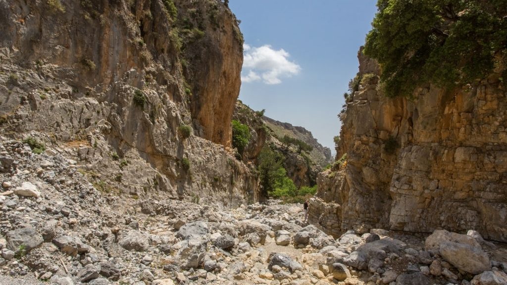
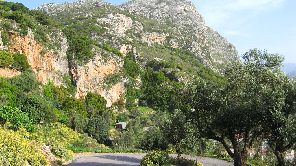
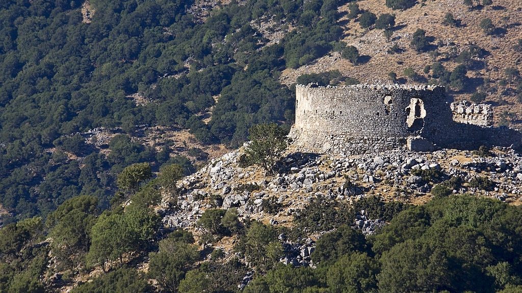
Thripti is a small and relatively unknown village in Eastern Crete, very close to both Ierapetra (20 km) and Agios Nikolaos (40 km) on the northern side. The route follows a relatively straight direction east to the village of Orino, meaning “mountainous” with gorgeous views of the plateau below. On the western side of Thripti, you will find the Gorge of Ha, one of the most spectacular and difficult to access on the island, recommended only for experienced and well-equipped…
Read More Read More
Τhripti is a small and mountainous village in Eastern Crete, on the path of the E4 walking trail, with a highest altitude of 1475 m in the peak of Afentis. The Thripti to Kavoussi route follows a northern direction towards Mirabello Bay. Kavoussi is a historic village with a steady population of about 600 people. The route from Thripti to Kavousi Starting from the Thripti settlement (1) we walk northwards, on the road that passes through the clusters of houses,…
Read More Read More
The village of Vassiliki in the eastern part of the Lassithi prefecture has taken its name from the nearby archaeological site of Vasiliki. First excavated at the beginning of the 20th century, architects have discovered important examples of Minoan pottery in the area. This is a very enjoyable part of the E4 walking path, that crosses through the spectacular Gorge of Ha. The route from Vassiliki to Thripti From Vassiliki (1), we follow the asphalt road eastwards and pass north…
Read More Read More
This part of the E4 trail in Crete starts just outside the Monastery of Panagia Vriomeni (only 14 km away from Ierapetra to the north). It then crosses parallel through to the village of Vassiliki that was named after a nearby Minoan settlement, from which significant pottery findings have so far been recovered. The monastery is not active anymore but a service and celebratory feast take place on August 15th, one of the biggest Greek holidays in honour of the…
Read More Read More
Prina is a traditional Cretan village 18 km south of Agios Nikolaos on the route to Ierapetra. The mountain scenery is complete with olive and pine trees and there are a few local tavernas and shops in the area. This is the starting point for the E4 trail that crosses through Messeleri village and finishes at the Monastery of Vriomeni following an eastward direction. The route from Prina to Vriomeni Monastery From the southern entrance to the village of Prina,…
Read More Read More
The forest of Selakano is arguably one of the most important ecosystems in Crete and is located about 20 km off the coast and the South Cretan Sea. The wild pine forest is situated between the peaks of Afendis Christos on the west (2141 m), and Spathi on the north (2148 m) and is a protected apiculture area. It has also given its name to a small village in the north exit of the forest that is the starting point…
Read More Read More
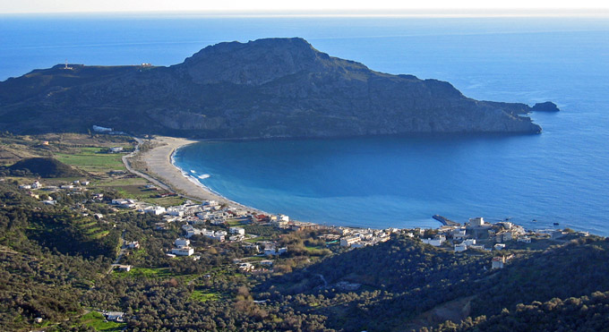
The plateau of Katharo (meaning “clean” in Greek), is located at an altitude of 1150 m, in Lassithi, in eastern Crete. It can be accessed by car, from the village of Kritsa in the east, and if you are following the E4 trail you can also walk from the village of Agios Georgios in the north. This is a wild and untamed area, where you will encounter mostly shepherds and goat herds, with magnificent views of the Lassithi plateau and…
Read More Read More
The village of Agios Georgios is a rural Cretan village at an altitude of 840 m, in the Lassithi Plateau. The distance from Malia in the north is only 24 km but it can also be reached by car from Agios Nikolaos (40 km). It also marks the starting point for the hike to the peak of Dikti in the south (2.148 m) and possible birthplace of the Olympian god, Zeus. To reach Katharo Plateau from Agios Georgios you can…
Read More Read More
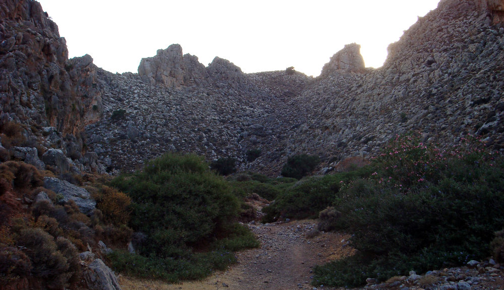
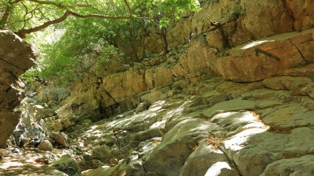
There are two options for those wishing to take the path from Agios Georgios village to the Plateau of Katharo. One of them is through the church of Agia Pelagia and is considered the easiest of the two; an easy and peaceful trail starting at an altitude of 840 m before reaching the plateau at 1150 m. The second path, described in detail below, crosses through the gorge of Havgas and is a more challenging route. The rocky canyon does…
Read More Read More
The Dikti mountain range in eastern Crete has impressive and stunning peaks for hiking and outdoor enthusiasts to explore. One of them is Varsami, which stands at an altitude of 1545 m. The Dikti mountain range is a protected ecological zone with vital wild flora and fauna. The path towards the forest of Selakano, one of the most important ecosystems in Crete, offers the chance to explore the stunning scenery of the Cretan mountainscapes. The route from Varsami to Selakano…
Read More Read More
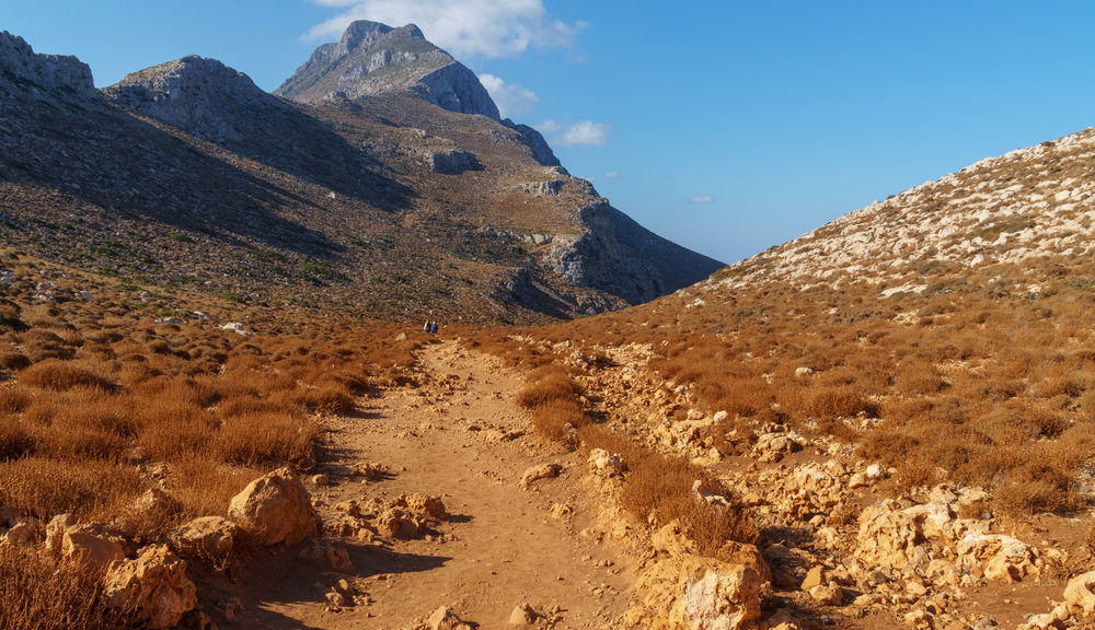
The plateau of Limnakaro in eastern Crete at an altitude of 1120 meters is the starting point for this route of the E4 trail that follows upwards from Lassithi Plateau that crosses through the summit of Afendis Christos to reach the spring of Varsami. The route from Limnakaro to Varsami Somewhat south of the shepherd’s stone hut (1) which is located at the western side of the plateau of Limnakaro, a cart track continues gently uphill, following the left (eastern)…
Read More Read More
The village of Agios Georgios in Lassithi, eastern Crete, is found at an altitude of 880 m and is 40 km away from Agios Nikolaos. A small village, that according to some legends was the birthplace of Zeus, Agios Georgios is often the start to hikes in the mountain range of Dikti. The route towards Limnakaro follows a south direction through the chapel of Agio Pnevma before reaching Limnakaro Plateau. The route from Agios Georgios to Limnakaro We follow the…
Read More Read More
This is a short and pleasant route that starts at the village of Tzermiado and finishes in Karfi. Visitors are rewarded with beautiful sprawling views of the plateau as they slowly ascend and stunning wildlife landscapes that showcase the rough beauty of Crete island. The small and picturesque village of Tzermiado in the Lassithi Plateau. From the north, it is only a 20 km distance from Malia, and if you prefer to drive inland from Agios Nikolaos the 40 km…
Read More Read More
This is a short E4 hike from the village of Kato Metochi to Agios Georgios, both situated in the stunning Lassithi Plateau and with beautiful countryside Cretan landscapes. Kato Metochi was used extensively during the Venetian occupation for cultivation, and seasonal makeshift houses would have been established for the workers. In recent years, the permanent population is ever decreasing and is close to 80. The nearby villages are Agios Xaralampos, Kaminaki, Avrakontes and Magoulas. One popular attraction in the area…
Read More Read More
The village of Kastamonitsa, only 40 km from Heraklion in the north, is the starting point for this short E4 route, that ends at Kato Metochi. Its strategic position by the entrance of Lassithi Plateau made this a common battlefield area, especially during the Ottoman Occupation. From Kato Metochi hikers can carry on to the village of Agios Georgios and explore the Dikti mountain range. The E4 route from Kastamonitsa to Kato Metochi From the north-eastern exit of Kastamonitsa (1)…
Read More Read More
The small town of Kastelli, 36km from Heraklion to the north, is one of the main and largest villages in the region with a population of about 4,000 residents. Grape and olive cultivation is the primary occupation in the area. There is also archaeological interest in the area, with pottery and other objects from the Minoan period found in the hill of Kastelli. The hiking path heading towards Kastamonitsa also passes through the village of Lyctus or Lyttos. According to…
Read More Read More
The monastery of Agarathos has taken its name from the plant “agarathia” in the Cretan dialect, or commonly known as the Jerusalem sage bush. The icon of Holy Mary that was found under the bush marks the location where the monastery currently stands. Only 24 km east of Heraklion, it is easily accessible for day visitors but also marks the start of the E4 trail towards the village of Kastelli. While we know it to be one of the oldest…
Read More Read More
Not far from the capital city of the island, Heraklion, (15 km to the south) you will find the picturesque town of Archanes. it is one of the most well-known villages in Crete, for its traditional and vibrant aesthetic, and restored houses that offer a glimpse into the history and lifestyle of the residents in previous generations. After soaking in the atmosphere around the area and tasting as many of the local delicacies as possible, you can do a day…
Read More Read More
A historical village about 18km south of Heraklion, Profitis Ilias, built on the hill of Rocca, had a strategic location and used as a fortress of the ancient city Lykastos and then, later on, took the name “Temenos” from the Venetian fort. This is an easy and enjoyable 11 km trail that leads to the village of Ano Archanes, one of the best restored villages in Crete with a vibrant and traditional aesthetic that welcomes visitors from all around the…
Read More Read More
To reach Profitis Ilias from the village of Ano Asites you can either cross through the stunning Venerato gorge or navigate the impressive Agios Antonios gorge. This trail explores the first option through Venerato gorge. Altogether the route is about 15km. Venerato took its name during the Venetian occupation, as the place where lords and nobles had their villas. The river that flowed in the gorge used to provide drinking water to the locals but recently the ecosystem is suffering…
Read More Read More
The gorge of Rouvas, also known as Agios Ioannis from the monastery nearby, is located in southern Crete, about 45 km from the capital Heraklion. The village of Rouvas nestled between Zaros and Gergeri has also given its name to the nearby forest of Rouvas. A very important ecosystem, with holly trees, pine, plane and cypresses on the south-eastern side of the Psiloritis range, the highest mountain on the island. The E4 route towards the village of Asites is a…
Read More Read More
The villages of Zaros and Rouvas are popular with travellers looking to explore the forest of Rouvas and nature enthusiasts. The area offers a lot of interesting hikes, including the short E4 route that crosses through the forest and the monastery of Agios Nikolaos. The trail is well-marked with beautiful scenery through small gorges, valleys and pretty Cretan villages. The E4 route from Rouvas to Zaros From Agios Ioannis, we follow the watercourse until its confluence with the main watercourse…
Read More Read More
This part of the E4 trail in Crete starts at the plateau of Nida and follows a path through the forest of Rouvas and small gorges. Nida is the ancient name of the Psiloritis mountain range, highest in Crete and a sacred ground that was closely linked to the worship of Zeus. Here you will also find the cave of “Idaion Andron” on the west side of the plateau where legend has it the Greek Olympian god was born. This…
Read More Read More
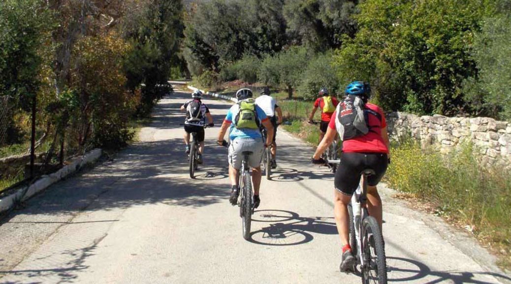
The village of Kamares on the southern edge of the Psiloriti mountain range is an important archaeological site. The Kamares Cave located higher up in the forest has unearthed a variety of significant Minoan pottery. The route is easy to follow and traverses the southern slope of the mountain range through small Cretan villages through dirt and paved roads. It is ideal for biking. The E4 route from Kamares to Zaros From Kamares (1), we follow the asphalt-paved, slightly uphill…
Read More Read More
The Akolita plateau in the Psiloritis range is the crossroad for most of the trails leading to the summit of Psiloritis (also known as Mount Ida). It descends from the plateau of Nida and reaches the village of Kamares. Kamares is a village of significant archaeological importance that has brought to light findings from the Minoan period. The E4 route from Akolita to Kamares The highest peak on the Psiloritis mountain range is Timios Stavros at an altitude of 2456…
Read More Read More
Zominthos is a small plateau on the north side of the Psiloritis mountain range in Crete. It is a 45 km distance from the capital Heraklion and a 15 km drive from nearby Anogia, the famous village and birthplace of legendary Greek singer Nikos Xylouris. It was an ancient settlement and archaeological excavations in the area are still ongoing. The trail is best attempted during the summer or spring months due to the heavy snow. From here you can also…
Read More Read More
Anogia is one of the most famous Cretan villages and a popular choice for weekend escapes from the capital, Heraklion. In the winter, the area is often covered in white and the small tavernas offer great hearty dishes to tired travellers. On the northern edge of mount Psiloritis at a height of 750 m, this will be the starting point as you traverse south towards the plateau of Zominthos. A Minoan settlement is still excavated on this location and the…
Read More Read More
The village of Garazo in northern Crete is about 28 km from the coastal resort village of Bali and 38 km from Rethymno. It is a traditional settlement at an altitude of 270 m with a notable Folklore Museum and stands surrounded by olive trees. The route towards Anogia crosses through the Monastery of Diskori with fantastic views of the landscape below. The E4 route from Garazo to Anogia From Garazo (1), we follow the main road to Anogia for…
Read More Read More
The small village of Houmeri or Choumeri is on the northern side of Crete island and 25 km from Heraklion. The route towards Garazo is a relatively short and easy hike that crosses through small villages and monasteries in the region. In Garazo, you will also find a Folklore Museum that is worth visiting to learn more about the culture and heritage of the area. The E4 route from Houmeri to Garazo From the northern exit of Ηoumeri (1), we…
Read More Read More
The village of Margarites is located on the northern part of Crete island, at a distance of 24 km from Rethymno. A small village, it is mostly known for its pottery makers which becomes evident straight away by the burst of colour and art on display all around. A unique village, showcasing the rich heritage and architectural beauty of the past, it is worth visiting and exploring in full. The path that leads to Choumeri village is relatively easy and…
Read More Read More
This part of the E4 route that traverses the length of Crete island, starts at the majestic monastery of Arkadi. At a distance of only 20 km from Rethymno, it is a popular attraction for religious and non-religious visitors, who come to admire this architectural landmark. The monastery is also a symbol of Cretan resistance for the role it played during the Cretan Revolution and war against the Ottomans. The route from Arkadi to Margarites passes through the archaeologically significant…
Read More Read More
The village of Prasies also known as Prasses is a traditional settlement only 8 km from the town of Rethymno in northern Crete. Architecturally the village has a number of notable buildings and structures, especially from the Venetian period. There are also more than half a dozen churches in the village, undergoing restoration works, including the church of Saint Anthony. The path crosses through a beautiful gorge to reach the majestic monastery of Arkadi. The E4 route from Prasies to…
Read More Read More
The villages of Armeni and Prasies each stand on opposite sides of mountain Vrisina. This part of the E4 trail route combines the mountainous landscapes with panoramic views of the city of Rethymno in the distance. Prasies is a traditional settlement with beautiful churches that is worth exploring in full. The E4 route from Armeni to Prasies From Armeni (1), we follow the road northwards, until the branch which leads to the Late Minoan cemetery. We take the right-hand branch…
Read More Read More
This is a short trail that starts at the village of Ano Valsamonero and travels east towards Armeni. Only 14 km away from Rethymno and 23 km from the popular fishing village of Georgioupoli, Ano Valsamonero, is nestled between small traditional villages and is a popular ecotourism destination for visitors looking to get away and relax in nature. The path also takes you through the Minoan Cemetery outside of Armeni. Access to the location is signposted and is open to…
Read More Read More
A pleasant and relatively easy part of the E4 trail on Crete island, this route starts at the village of Agios Konstantinos, situated only 20 km from Rethymno. The path is mainly on dirt and paved roads and crosses through neighbouring villages before reaching Ano Valsamonero. From here you can carry on towards Armeni where the Late Minoan Cemetery ruins can be found. The E4 route from Agios Konstantinos to Ano Valsamonero At the southern exit (1) of Agios Konstantinos,…
Read More Read More
Timios Stavros is the name of the summit of the Psiloritis mountain range on Crete island, and highest on the island. The mountain is also known as “Mount Ida“. From an altitude of 2456 m, the path descends steadily towards the second highest peak, Agathias (2424 m) until it reaches the plateau of Nida. The shortest way to the top starts at the plateau of Laos Mygerou and takes about 2 hours. The E4 route from Timios Stavros to Nida…
Read More Read More
Psiloritis otherwise known as Mount Ida is the tallest mountain in Crete island. The summit of Timios Stavros at 2456 m is its highest peak. You can get there by car on dirt roads from the village of Kouroutes but there is also a hiking trail that is part of the E4 route that starts at Fourfouras. From the shelter, which is at an altitude of 1600 m, the climb to the top takes approximately 3 hours. The route from…
Read More Read More
Fourfouras is a small village on the western edge of the Psiloritis mountain range in Crete and belongs to the regional unit of Rethymno. It is the starting location for the E4 trail that ascends to the summit of Mount Ida (another name for Psiloritis). The E4 trail from Fourfouras to Troumbotos Prinos (Mountain Shelter) From Fourfouras village (1), we follow the asphalt road for about 150 m, in a southerly direction. At the beginning of an uphill dirt road…
Read More Read More
This is a very pleasant part of the E4 trail on Crete island that starts at the village of Gerakari and will bring you to Fourfouras, on the western slope of the Psiloritis mountain range. From here you can ascend to the summit towards the highest peak of the island, Timios Stavros (2456 m). Gerakari is only a 35 km drive from Rethymno and 19 km from Arkadi monastery. It is a beautiful mountainous village that stands at an altitude…
Read More Read More
This part of the E4 route starts at the village of Spili (meaning cave) and finishes in Gerakari. The path follows a southern direction first, towards the village of Kissos and passes through the northern slopes of mount Kedros before coming to Gerakari. Spili is only 30 km from Rethymno and is one of the busiest villages in the area. The village is known for its refreshing waters and natural springs that come flowing out of a series of lined…
Read More Read More
This part of the E4 route in Crete island is relatively easy, on dirt and paved roads. It starts at the village of Agkouseliana, that stands at the northern edge of the Koxare plateau and crosses the villages of Katsogrida, Atsipades, Plakias and Mixorrouma. The gorge of Kourtaliotiko frames the scenery in the south. Archaeological findings in the region of Agkouseliana have brought to light objects from the Roman period and it also played an important role much later during…
Read More Read More
In this part of the E4 route, we are at the edge of the regional unit of Rethymno and will travel from Moundros or Mountros to the village of Agkouseliana. The path travels south past charming villages and running waters. Moundros is built at an altitude of 280 m and is a traditional settlement with very few permanent residents and has several abandoned buildings from the Byzantine period and impressive churches. The E4 route from Moundros to Agkouseliana From the…
Read More Read More
Argiroupoli stands at the very border of the regional unit of Rethymno and is a popular destination for visitors to the island. Previously known as Lappa from the ancient city that stood there, the village is full of traces of modern and ancient civilizations, and is a traditional settlement. The springs of Argiroupoli and the small waterfalls complete this idyllic scene where visitors come to enjoy a meal and the natural landscape. The hike towards the village of Moundros is…
Read More Read More
This route starts at the regional unit of Chania in the village of Kallikratis which is part of the southern municipality of Sfakia. The starting point of Kallikratis is a 24 km drive from Sfakia and a 28 km from Georgioupoli to the north. While a long route (approximately 16 km) most of it is on dirt and paved roads. It is all worth it though, to reach Argiroupoli, where the refreshing springs, small waterfalls and plane trees offer a…
Read More Read More
The small village of Alones, 37 km from Rethymno is built at an altitude of 510 meters and is located on southern Crete and the northern side of Kryoneritis mountain. In ancient times it was an important centre, due to its close proximity to Phoenecia the port city of Ancient Lappa (modern-day Argiroupoli). The path cross through lush green landscapes, imposing plane trees and the village of Velonado, and Moundros. The E4 route from Alones to Agios Konstantinos From Alones…
Read More Read More
The villages of Ano and Kato (Upper and Lower) Rodakino in Crete, are located 42 km from Rethymno on the southern coast and only 27 km from Hora Sfakion. The villages are framed by the mountainous backdrop of the peak of Krioneritis mountain to the north and the vast and long beach of Korakas. However, due to the remote nature of the area, the area does not see a lot of visitors. The E4 trail starts at Kato Rodakino and…
Read More Read More
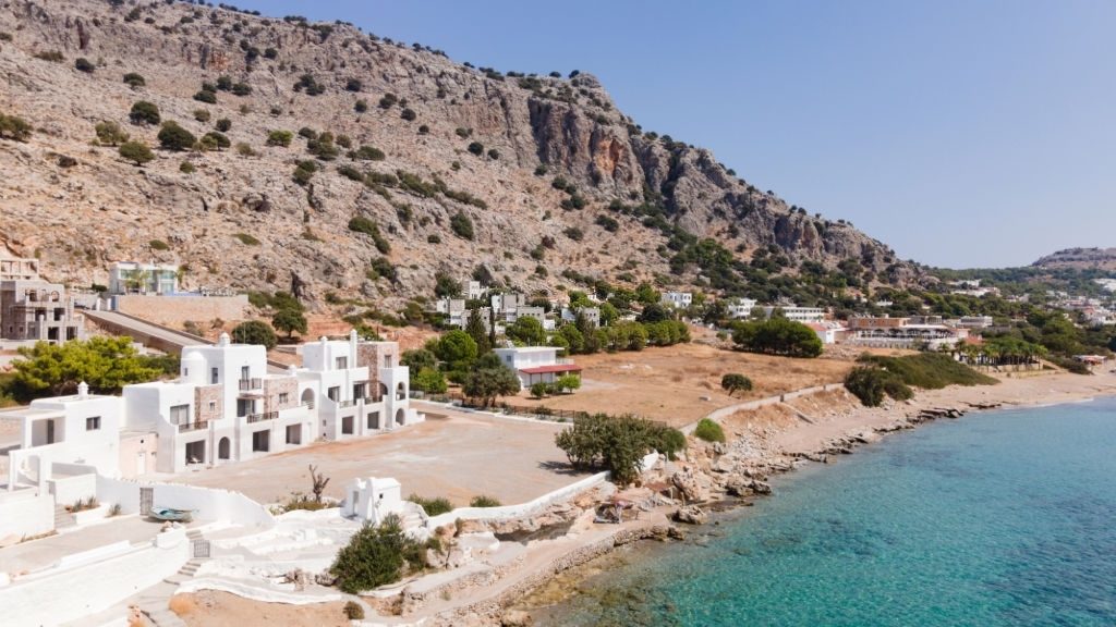
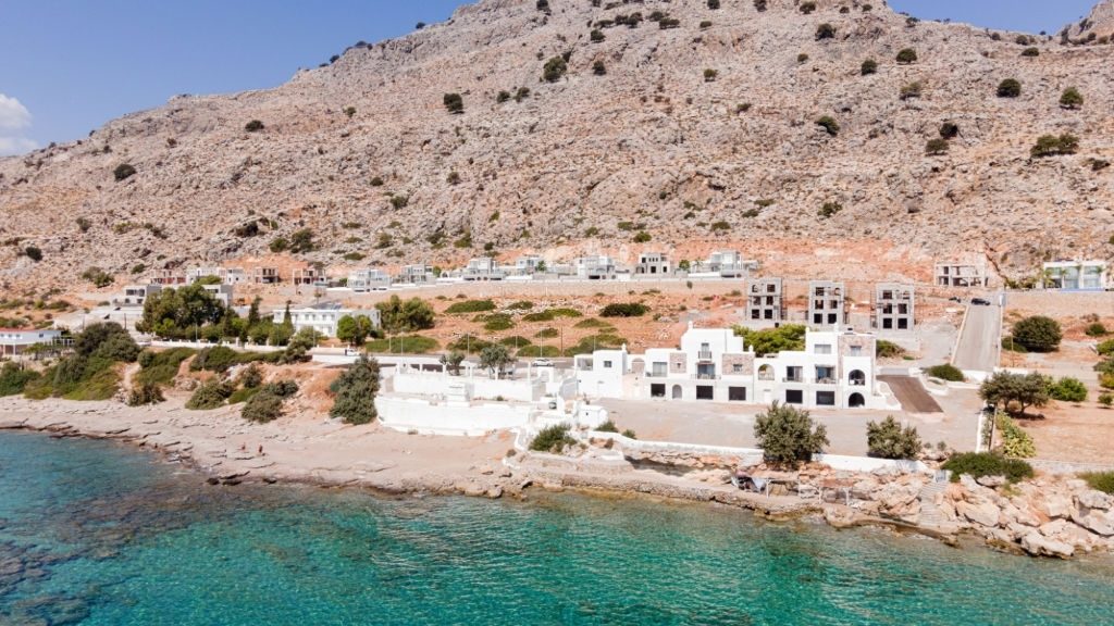
Patsianos is a traditional village on the southern side of Crete island, only 3 km away from the coastal town of Frangokastello in the region of Sfakia. According to some accounts, the name of the village comes from the Italian word for “peace”. The route follows the southern route towards the coast, before following on to the villages of Ano and Kato (Upper and Lower) Rodakino. Here the beautiful beach of Korakas on the south and the high mountain peaks…
Read More Read More
Kallikratis is a small Cretan village that belongs to the municipality of Sfakia and is part of the Chania regional unit on the southern side of the island. A part of the E4 European path starts in Kallikratis plateau and travels south towards the village of Patsianos. In this route, you will cross through the gorge and be awarded beautiful views of the South Cretan Sea and the charming coastal town of Frangokastello. You can reach Kallikratis on the E4…
Read More Read More
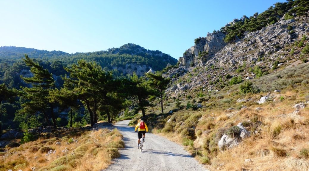
The village of Askifou in the regional unit of Chania, in Crete, is located just 24 km from Georgioupoli to the north and 20 km from Hora Sfakion to the south. There are five settlements in Askifou, including Petres, Ammoudari, Stravorachi, Goni and Kares. Ammoudari is probably the busiest centre and where visitors can find the most amenities. This part of the E4 trail is mostly on dirt and paved roads and while long (18 km), takes just over 6…
Read More Read More
The village of Askifou in the southern regional unit of Chania is on the middle of the road that connects Hora Sfakion to the south and the village of Vryses to the north. The village includes 5 settlements that are nestled next to each other, which can be confusing. These are Ammoudares, Petres, Goni, Kares and Stravorachi. Here you will also find a War Museum, focused on the part Cretan fighters during World War II. From here an E4 trail…
Read More Read More
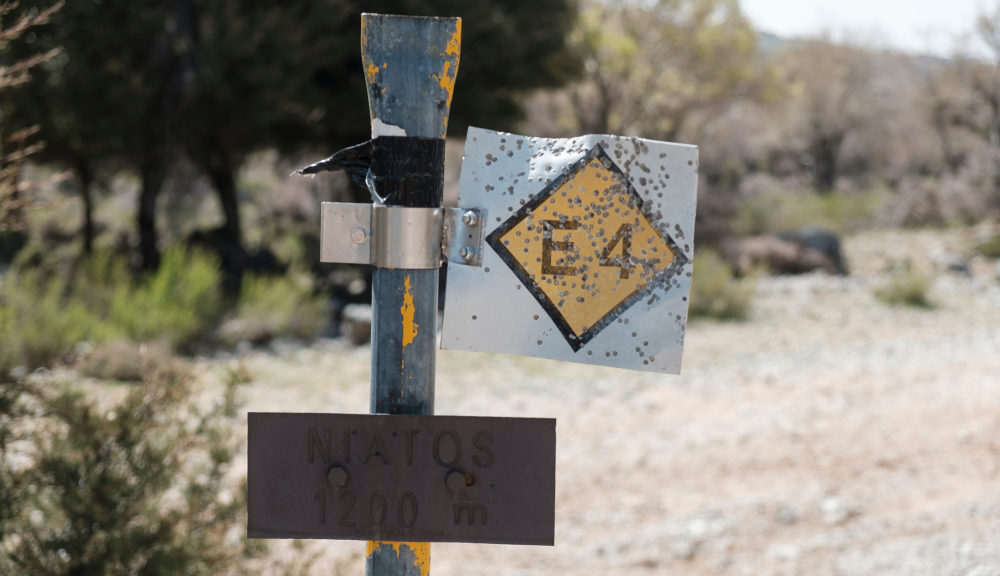
The Niatos plateau in the regional unit of Chania is an isolated region accessible by car or on foot. With the White Mountains on one side and the forest of Asfendou on the other, this is a stunning part of the E4 trail to explore. The path is often poorly marked so a lot of care should be taken. If you are driving from Chania, the distance is just over 60 km. and will take you through the village of…
Read More Read More
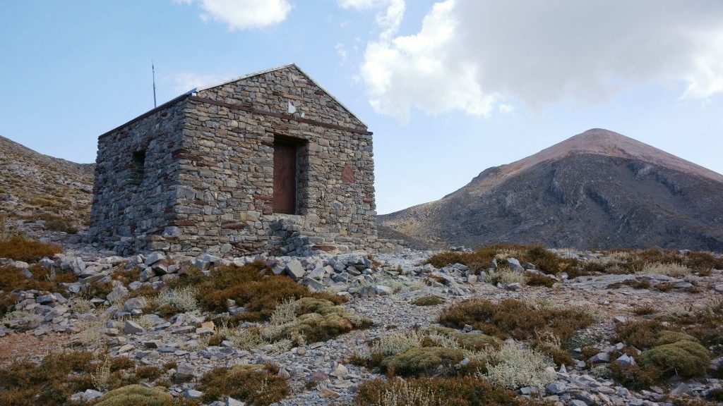
The shelter of Katsiveli, also known as Christos Chouliopoulos, is located deep in the White Mountains of Crete and stands at an altitude of 1980 m. Access is possible only by hiking, either from Niatos Plateau and the E4 trail that ascends from Tavri shelter, or from Kallegris shelter to the west. From here you can also hike to the summit of the White Mountains, Pachnes (2453 m). Apart from water, there are no other facilities in the shelter and it…
Read More Read More
An overnight stay in the Kallergis Mountain Shelter is an amazing experience for anyone who loves mountains, nature and wants to explore another side of Crete island. From here, you can hike to the summit of Lefka Ori (or White Mountains – altitude 2454) in the regional unit of Chania, and the second-highest mountain range on the island, narrowly behind Psiloritis (2456 m). The E4 route from Kallergis Mountain Shelter to Katsivelli From the shelter (1), we follow a dirt…
Read More Read More
Omalos is a small plateau and village, in the regional unit of Chania in Crete island. It is located 35 km from Chania to the north and is surrounded by the peaks of the Lefka Ori (White Mountains). The area is mostly known to nature and hiking lovers as the starting point for the 18km long Samaria gorge hike. There are frequent bus routes towards nearby Xyloskalo (5 km distance) which is where the information centre and Museum of Faraggi…
Read More Read More
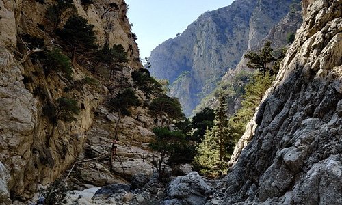
The gorge of Samaria offers one of the most well-known and impressive hiking routes of Crete. The gorge is accessed from its northern entrance at Xyloskalo, the southern edge of the plateau of Omalos. There are daily bus routes to Xyloskalo from Chania. Crossing the gorge is only allowed during certain hours, from 06:00 to 15:00. That means that for those who have reached Omalos or the Kallergis Mountain Shelter by hiking on the E4 from Sougia, must schedule their…
Read More Read More
Sougia – Agia Irini Sougia is a small, charming coastal village on the south coast of Crete, about 70 km away from Chania. A wild natural landscape, with a long stretch of beach, it is located at the exit of the Agia Irini gorge and very close to the most famous hike on the island, the gorge of Samaria. In the past decades, Sougia has attracted tourists that seek an isolated and remote destination spot. Hippies and nature lovers from…
Read More Read More
Sougia – Koustogerako There are a few accommodation options in the village of Omalos and Xyloskalo, however, due to the popularity of the hike, it is best to book ahead if you want to stay here. The E4 route from Sougia to Omalos (through Koustogerako) The village of Sougia on the southern coast of Crete island is a haven for alternative holidaymakers that want to relax by the beach and hike some of the numerous paths in the region, including…
Read More Read More
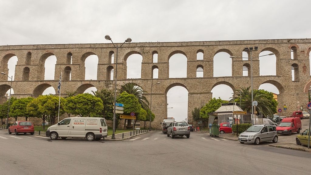
The charming coastal village of Chora Sfakion, in the regional unit of Chania in southern Crete, and capital of Sfakia, is a popular holiday destination for visitors all around the world. A remote and wild area, with a long history, most notably as a centre for the resistance forces against the Ottoman Occupation, it flourished during the Venetian period due to its harbour and active trading routes. Nowadays, most visitors come to Hora Sfakion long enough to board a ferry…
Read More Read More
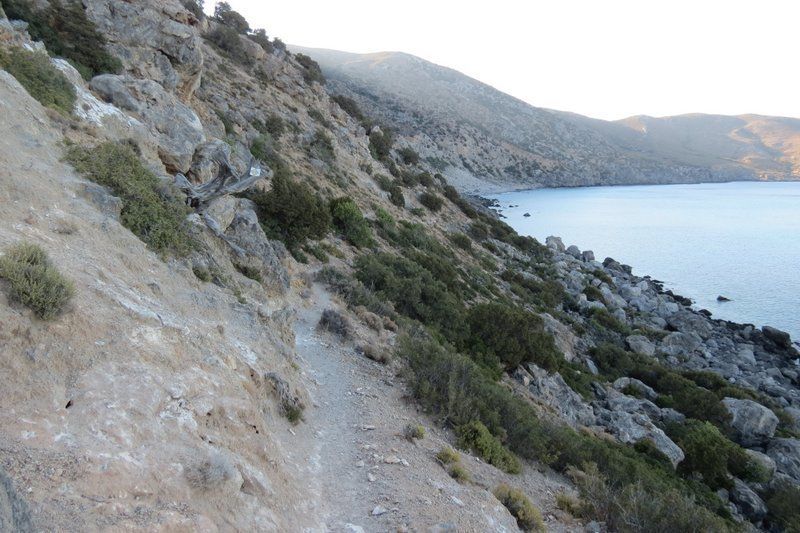
Loutro, meaning bath, is a small harbor village on the southern coast of Crete island. Well-protected and with turquoise waters, Loutro can only be accessed by boat or foot. While a remote and not easily accessible destination, Loutro attracts a wide range of people, from nature enthusiasts, that seek to spend a few days here after a hike, as well as yachters and laid back travelers looking for an intimate destination away from the cities. Hiking the E4 trail eastwards,…
Read More Read More
The small chapel of Agios Pavlos is located on the coast next to the beach of the same name, east of Agia Roumeli. It can be reached on foot from the E4 route starting in Agia Roumeli (approximately 5 km) or the village of Agios Ioannis to the north. There are no amenities nearby so make sure to come prepared. From Agios Pavlos, you will follow the path towards Loutro, another secluded and hard to reach, coastal village, with its…
Read More Read More
This is the first part of the E4 route that connects Agia Roumeli to Loutro on foot. Loutro doesn’t have road access, and the only other way to reach this small coastal village is by boat. Agia Roumeli is mostly known as the place you end up in for a few hours after hiking Samaria gorge. Nestled between the high mountain tops and the long beach on the Libyan Sea, this is another spot you can only reach on foot…
Read More Read More
This part of the E4 trail starts at Domata beach on the southern coast of Crete island, east of Sougia, and south of Samaria National Park. To reach the beach you will have to walk through Poikilassos from Sougia and cross picturesque bays and beautiful remote beaches. The only other access is by boat. This is a challenging but rewarding trail and you will most probably have the beach and surrounding area all to yourself, especially in the offseason. The…
Read More Read More
This route starts in the ancient town of Poikilassos on the southern coast of Crete. Information about the city is scarce and all that remains now are a few scattered ruins. Poikilassos marks a midpoint between Sougia and Agia Roumeli that crosses the E4 trail on the island. From Poikilassos, the path continues to Domata beach, an unspoiled and remote part of the island that few people get to see. The route is quite challenging and requires walking next to…
Read More Read More
Sougia is the starting point for a lot of different hikes on the south coast of the island of Crete. Located about 70 km from Chania, Sougia is known as an alternative and laid back holiday destination, where tourists come back year after year; while the hippie vibe has lessened, a lot of the small bays around Sougia are nudist friendly and mass tourism has yet to affect the village. From Sougia, a coastal E4 route begins that takes you…
Read More Read More
Sougia, located 70 km from Chania, is a small coastal village on the southern coast of Crete island. The island has been relatively unaffected by mass tourism, despite the influx of visitors that are primarily drawn by the nearby Samaria gorge hike. In the past, Sougia was an alternative and hippie holiday destination, and a lot of that laid back charm has remained, even if the nudist beaches have moved further away from the main centre. You can reach Sougia…
Read More Read More
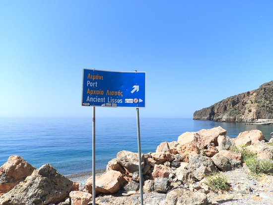
Palaiochora is one of the most well-known southern Crete holiday destinations. Only 77 km from Chania to the north, this small peninsula with a coastline that stretches for about 11 km, is renowned for its stunning beaches and rugged mountain views creating a unique contrast. When following an east direction on the E4 trail, the path continues towards the ancient city of Lissos and its beautiful beach with turquoise colored waters. From Lissos the path carries on until Sougia. The…
Read More Read More
The chapel of Agios Ioannis is the starting point for this part of the E4 hiking trail on Crete island. Located on the southwest point of Crete, it can be reached by car or foot; the distance from Palaiochora is 13 km. While it is relatively close to one of the most famous beaches of the island, Elafonissi, (a bay where Kedrodasos Beach is located), the narrow and windy roads make it hard to explore in a short period of…
Read More Read More
The monastery of Chryssoskalitissa on the west coast of Crete island takes its name from the Greek “chrysso” and “skali” meaning “golden step”. The church, which is dedicated to the Virgin Mary, has 98 steps and according to the story, one was gold. However, only true believers can see it. From Chania, the monastery is accessible by car (72 km) and is situated on a high rock with stunning vistas of the sea and landscape below. Nowadays, the monastery operates…
Read More Read More
The village of Kefali is a small settlement on the west coast of the island of Crete on the road that leads towards the famous beach of Elafonissi. In addition to a few shops and basic amenities, the village has several notable Byzantine churches. The route towards Chrysoskalitissa monastery is relatively short and easy to follow. From there, most visitors will want to carry on towards Elafonissi beach for a refreshing swim and a chance to see one of the…
Read More Read More
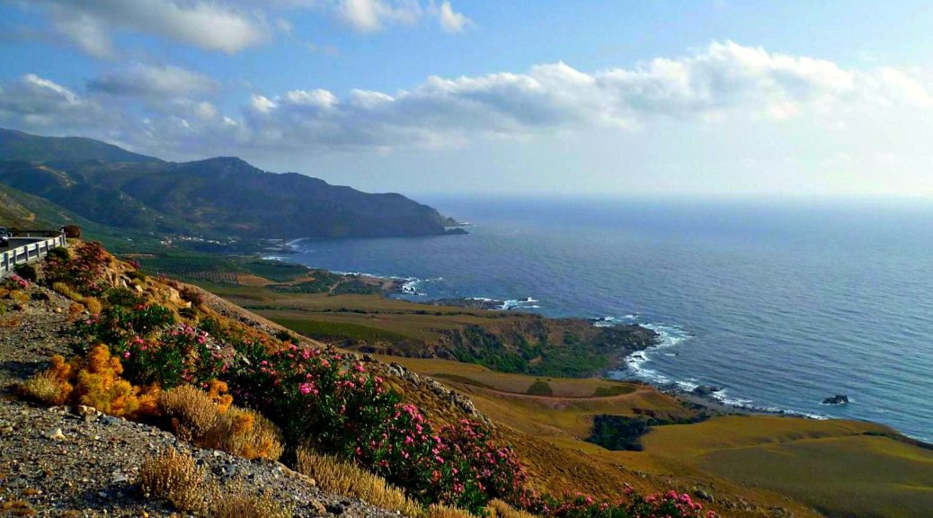
Sfinari is a small fishing village on the west coast of Crete island, in the regional unit of Chania. It is located 56 km from Chania and 18 km from Kissamos. Right by the water, the beach of Sfinari is a quiet bay with a small sandy and pebbly beach and cold refreshing waters. You can also reach the village by bus. This route will take you south towards Kefali village, which is on the way to Elafonissi beach. There…
Read More Read More
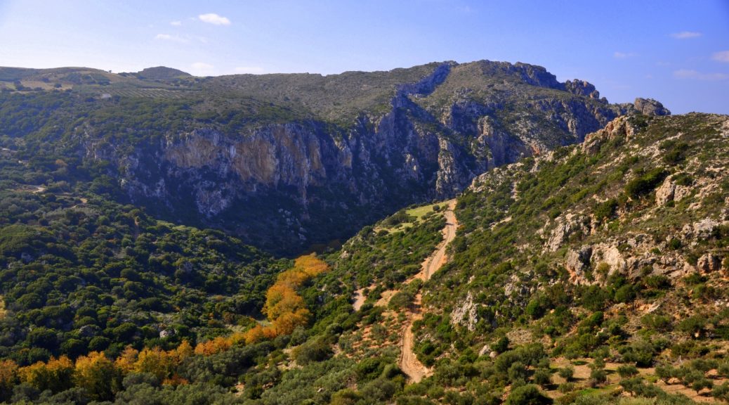
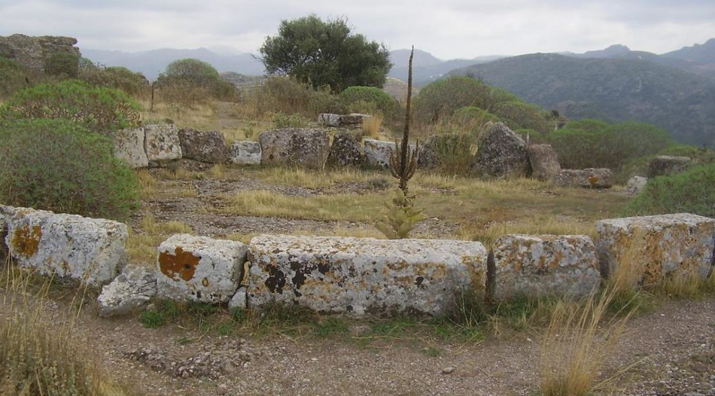
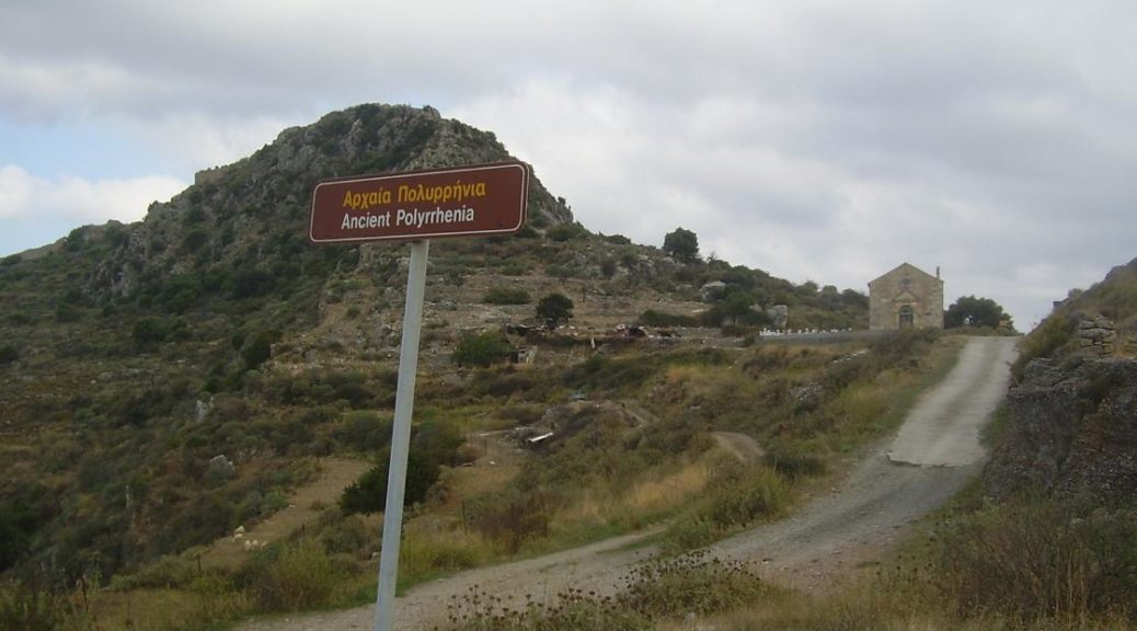
Polyrrinia was an ancient settlement in northwestern Crete and you will find the name spelled a variety of different ways, including Polirinia, Polyrrhenia and Polyrrhen, so don’t be confused. The meaning derives from the greek “poly” (meaning plenty) and “rinia” (sheep) as this was probably the main occupation of the people. Located only 7 km from Kissamos, all that remains of the city are a few ruins and you can also climb to the top of the acropolis and enjoy…
Read More Read More
The beginning of the Cretan part of the E4 European long-distance path is at Kasteli Kissamou (1), the westernmost town of Crete, which lies on the shore of the bay of Kissamos. It can be reached by car from Chania or by boat from Cythera and the Peloponnese. The E4 path traverses the whole length of the island, from Kissamos moving south towards Elafonissi and then across the coastline towards Paleochora until it reaches Chora Sfakion. The length of the…
Read More Read More
Nissimos plateau is a relatively small and lesser-known but beautiful plateau in the municipality of Lassithi. It is located north of the settlement of Tzermiado and Lassithi Plateau, at an altitude of 890 m.
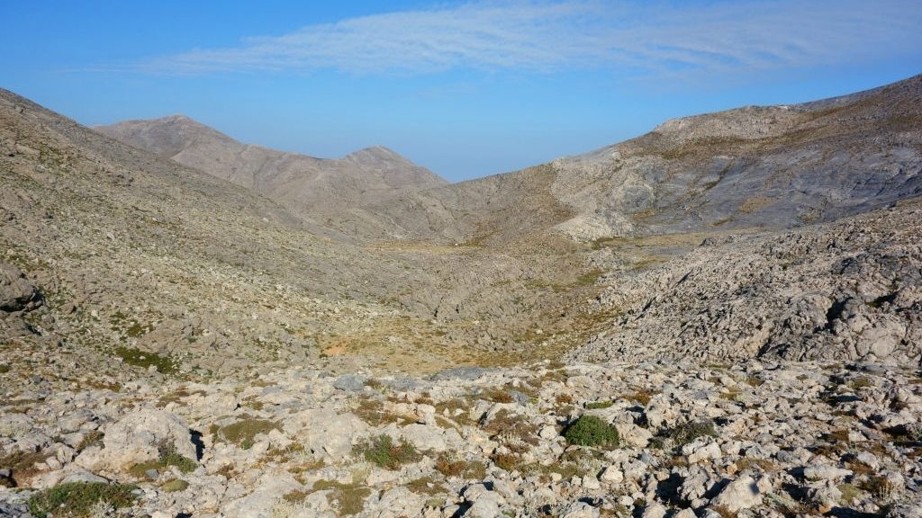
Niatos is a small plateau at an altitude of 1,200 meters and is a polje, like most of the plateaus of Crete.
Limnakaro is a small but wonderful plateau at an altitude of 1150 m, known mainly to climbers and adventure enthusiasts.
The plateau of Katharo (meaning “clean” in Greek), is located at an altitude of 1150 m, in Lassithi, in eastern Crete. To its southwest rear the high peaks of the Lassithi mountains. It is linked geomorphologically and hydraulically with the main and lower Lassithi plain through the Havga gorge which for most of the time runs like a torrent.
Kallikratis is a small plateau, named after the village of the same name, located in the White Mountains in Sfakia province, at an elevation of some 540 m.
The plateau of Anopolis is just 13 km from Chora Sfakion. A winding road climbs the bare mountains, offering extensive views out towards the little island of Gavdos; it ends in a pine-covered plain. Anopolis was an important settlement; the area and village are named after the ancient city of the same name.
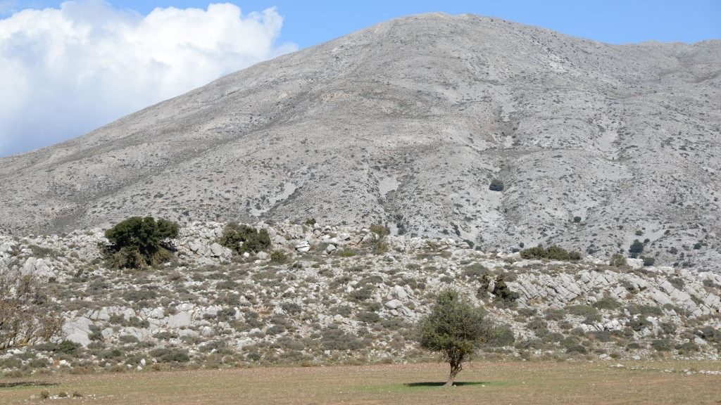
The Omalos Plateau of Viannos is located at the south-east Dikti range around a cluster of enclosed basin-like plains and is the largest of the lot.
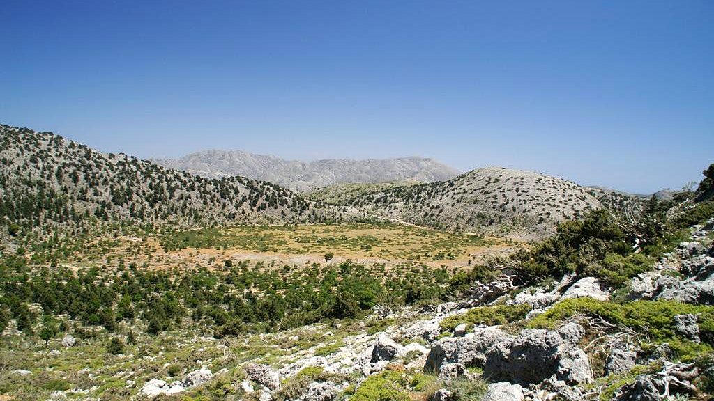
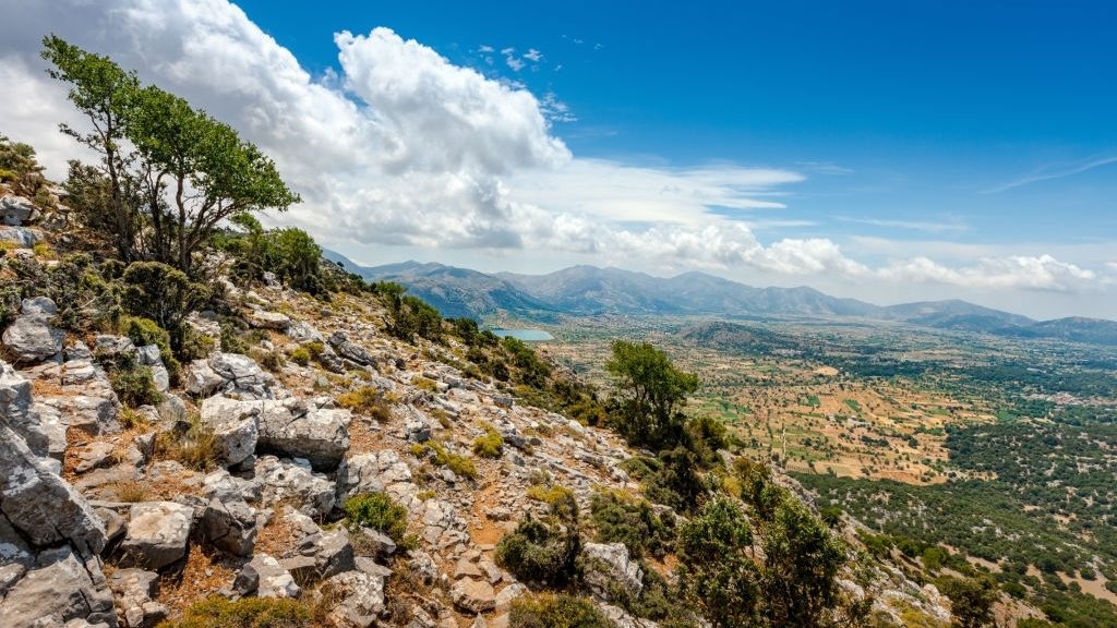
Omalos Plateau is located at the White Mountains range and is one of the great plateaus of Crete. An irregular circle, a polje (a large, flat plain found in limestone karst regions), of some 6 sq km, it is surrounded by peaks – Koukoule (1640 m) to the east, Gigilos (2005 m), Volakia (2117 m), and Psilafi (1936 m) to the south, with Trouli (1455 m) west and Katrinari (1318 m) to the north. The north region, called Lakkiotikos Gyros,…
Read More Read More
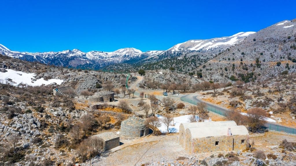
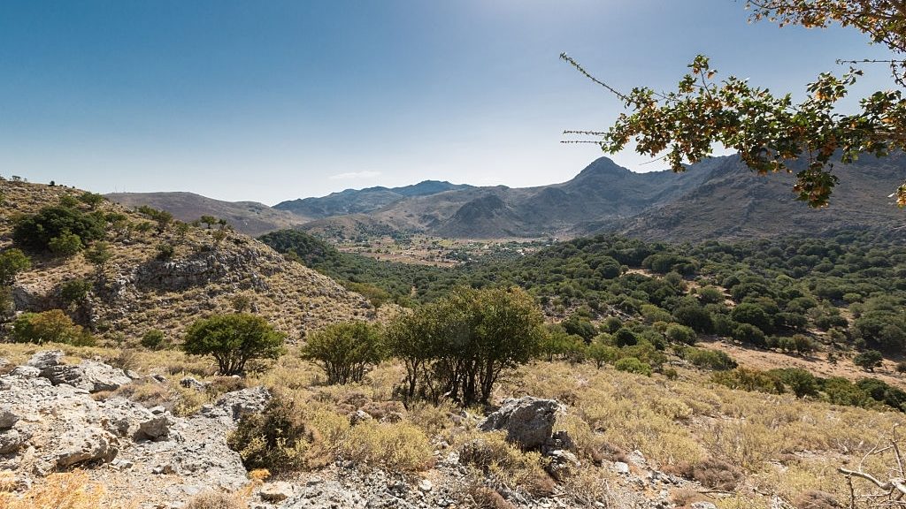
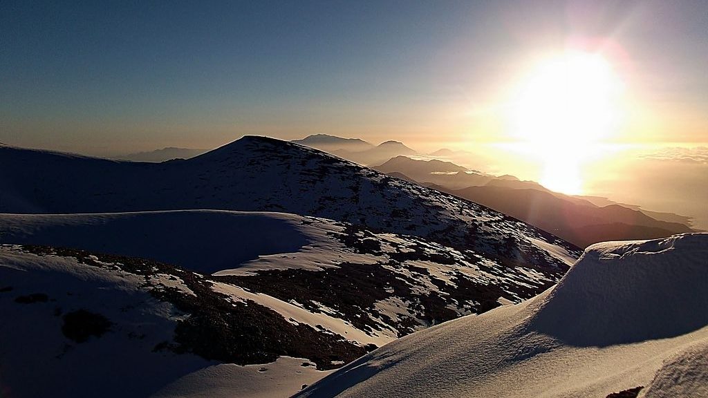
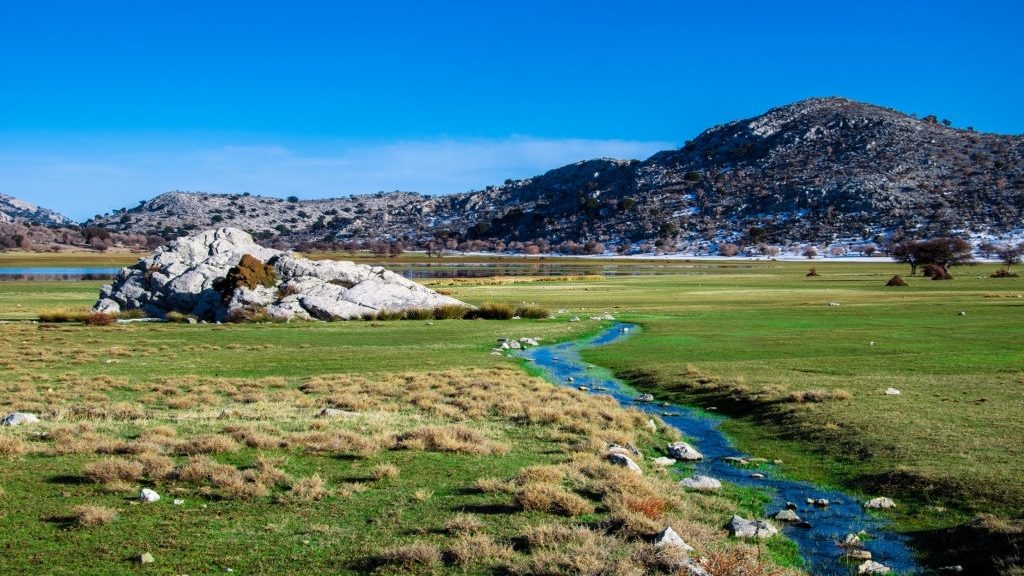
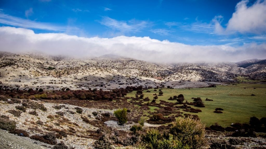
At an altitude of 850 m, the Lasithi Plateau is the largest mountain plain in Crete – and the only one occupied all year-round. Roughly ovoid, it runs some 11 km east-west and 6 km north-south. Surrounding it are the peaks Selena (1559 m) at the north, Afendi (1588 m) and Louloudaki (1163 m) west, Spathi (2148 m) to the south and Katharo (1564 m) and Varsami (1545 m) to the east. Animal-rearing and agriculture were the main occupations in…
Read More Read More
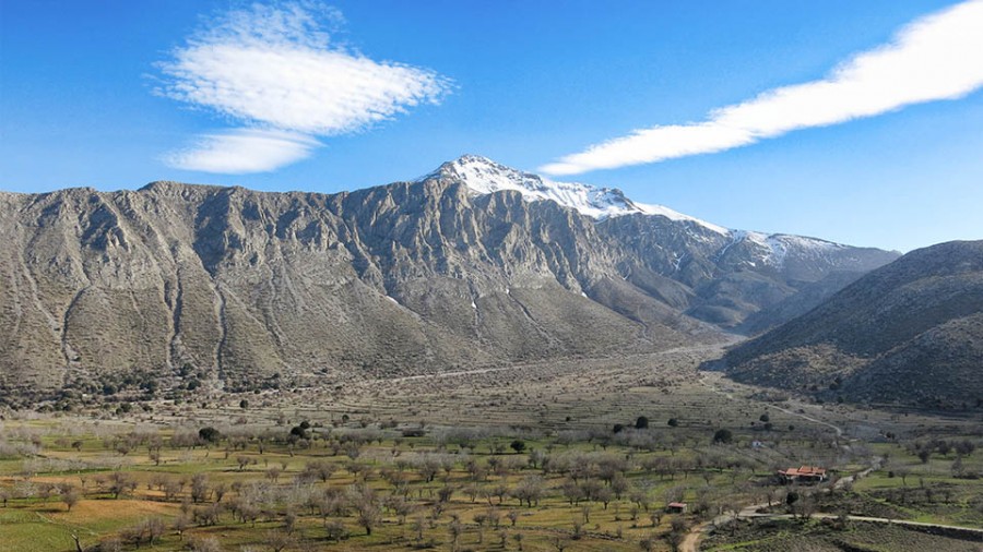
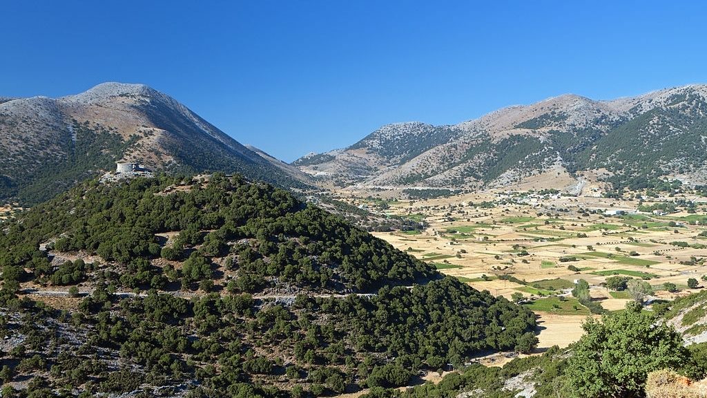
Nida Plateau lies at the heart of the Psiloritis or Ida range. Its name comes from a contraction of the words “στην Ιδα” (stiN Ida). In shape, it is roughly triangular, with its shortest side at the south, the so-called Passage of Milias, through which the southern foothills towards Mesara can be accessed. East of the plain is the peak of Skinakas. Here at a height of 1750 m, we find the only Astronomical Observatory on Crete.
Askifou Plateau is located in the west part of the White Mountains – on the road from Sfakia towards Apokoronas and Chania. It resembles a cup and is surrounded by the peaks of Kastro (2218 m) to the west, Trypali (1493 m) to the east and Angathes (1511 m) to the south. Around the edges of the plain are the villages of Ammoudari, Kares, Kosto, Petres, Mesa and Exo Goni and Stavorachi. The plateau has been cultivated for a very…
Read More Read More
The Astrakiano gorge starts just outside Astraki and crossing the hinterland of Heraklion ends in the area of Karteros.
Kalo Chorio literally translates to “Nice Village” which is what this unknown and remote area of the eastern part of Crete island offers. A pleasant village, with close access to the coast and beautiful beaches, traditional, sleepy settlements and friendly locals.
The gorge of Knossano spans a length of 6 km and is essentially the natural continuation of the sacred mountain Yukhta (or Giouchta).