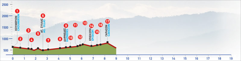
49 Houmeri – Garazo
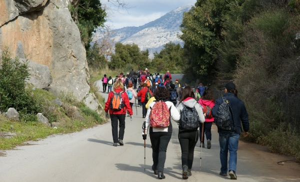
The small village of Houmeri or Choumeri is on the northern side of Crete island and 25 km from Heraklion. The route towards Garazo is a relatively short and easy hike that crosses through small villages and monasteries in the region. In Garazo, you will also find a Folklore Museum that is worth visiting to learn more about the culture and heritage of the area.
The E4 route from Houmeri to Garazo
From the northern exit of Ηoumeri (1), we follow the country road in a northerly direction. We pass an orange grove, and a crossroads on our left side, and continue northwards until we reach a drinking fountain on our right. Immediately after the fountain, two metal transmission towers (2) can be seen. We follow the right-hand branch of the dirt road which runs between them.
After approximately 250 m, we can distinguish the old footpath (3) on our right. We take it and descend to the ravine, pass onto its eastern bank and then climb the slope, in an easterly direction. 150 m after the ravine, we come to a dirt road (4), which we follow eastwards for 350 m.
At the point where the unsurfaced road splits (5), we begin to descend on a path hard to discern, which leads us to the small settlement of Agios Syllas (6). We cross the bridge of the settlement and turn right, following the asphalt road (7). We continue for another 500 m on the main road until we reach the left branch of a cement road (8), which we take. After approximately 1 km, we arrive at Dafnedes (9). For visitors wishing to stay the night, Dafnedes has a few accommodation options of traditional stone mansions.
The road leads us to the small square of this almost abandoned village, where the haunting church of St. George stands. We follow the dirt road south of the village, pass by the cemetery and continue straight on for about 250 m. We then turn onto the left branch of the road, in a south-easterly direction, and continue straight, ignoring any other branches, until the road ends, next to a ravine (10). Here, the remains of a water pump can be seen.
From this point on, we pass through several orchards, as well as a flat area with olive and lemon trees, and then come to a dirt road (11); we follow this path until we get to an asphalt road (12), which we then take in a south-easterly direction. After 600 m, we come to the main road (13) which we follow to the right, towards Episkopi (14). Due north of the cemetery of Episkopi, we turn eastwards into an unsurfaced road, from the end of which we begin to descend the small gorge of the abandoned village of Mousses (15).
Carob trees dominate and shrubs make our walking difficult.
We cross a dirt road and a watercourse and then go up to the ridge of a low hill. There, we come to a dirt road (16), which runs along a small stream and then crosses it, at a spot where an old stone fountain can be seen (17). From this point on, the unsurfaced road ascends to the village of Garazo (18).
| Path Length | 8 km |
|---|---|
| Hiking Duration | 3 hour |
| When to hike | Spring, Autumn, Summer, Winter |
| Path Region | Rethymno |