60-61 Ano Asites – Venerato – Profitis Ilias
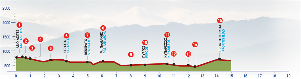
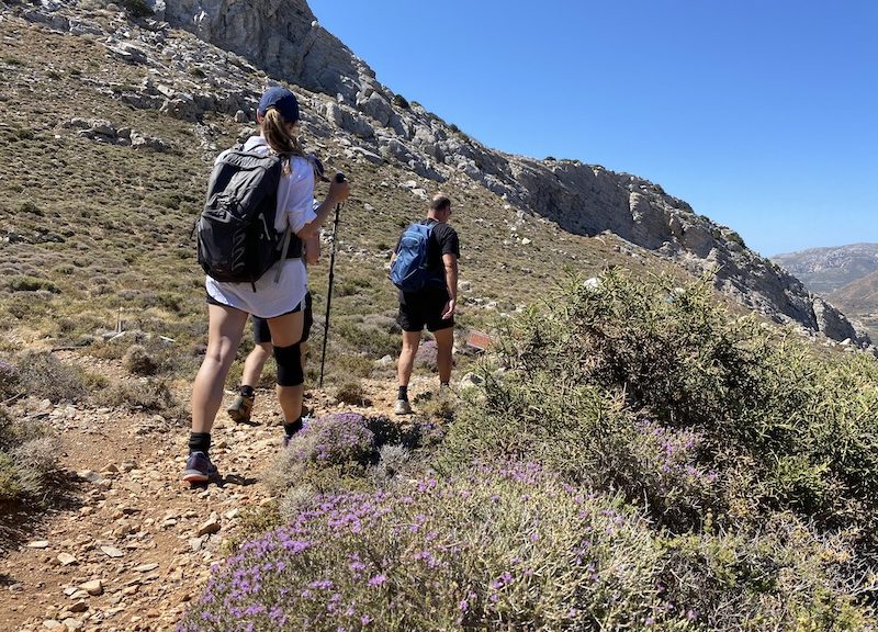
To reach Profitis Ilias from the village of Ano Asites you can either cross through the stunning Venerato gorge or navigate the impressive Agios Antonios gorge. This trail explores the first option through Venerato gorge. Altogether the route is about 15km.
Venerato took its name during the Venetian occupation, as the place where lords and nobles had their villas. The river that flowed in the gorge used to provide drinking water to the locals but recently the ecosystem is suffering the effects of human intervention.
A beautiful landscape that leads to the historic village of Profitis Ilias and its Venetial fortress on the hill that is worth exploring in full.
The E4 route from Ano Asites to Profitis Ilias (through Venerato gorge)
We walk along the narrow alleys of the old settlement of Ano Asites (1), cross the small village square, where the church of Agios Ioannis and an old drinking fountain are, and after the last houses of the village, we turn northwards. Next, we walk for 130 m, turn right (2), and continue for another 100 m, until we reach a bridge (3). From the bridge, we turn left (northwards) and continue parallel to the watercourse; this road leads us to the chapel of Agios Antonios (4).
From the chapel, at the entrance of which there is a water spring and a rest area, we follow a path which is difficult to discern. Having come by an old lime kiln, we begin to descend the bushy slope, having a rocky elevation on the eastern side of a small gorge as an orientation point. We descend to the watercourse, at a spot where a hollow with traces of stalactites can be seen toward the western, almost vertical rocky wall of the gorge. We follow the watercourse, underneath plane trees and oleanders. After 1,5 km in total from Agios Antonios, we come to an unsurfaced road which crosses the stream.
We get onto the right (eastern) bank (5) and follow the main dirt road in a south-easterly direction. We leave the chapel of Faneromeni behind on our left, cross a plateau with olive groves and vineyards and after 1,3 km in total from the outlet of the gorge, we arrive at the village of Kerasia (6). We pass through the narrow lanes of the village until we get to a small square, where several traditional Greek kafeneia can be seen. From there, we follow the asphalt road eastwards. This road passes below the main road that connects Heraklion to Mires, crosses through a plain with vineyards and leads to Venerato after approximately 1,5 km (7).
From Venerato, we follow the signs towards the Monastery of Paliani.
Following the downhill asphalt road, we cross the bridge over a small stream and then climb the slope eastwards. Opposite, on the northern side of a small gorge, the old settlement of Venerato is located. We continue for 1,5 km and then arrive at the courtyard of the Monastery of Paliani (8). Next, we follow the dirt road, which begins north of the small chapel outside of the courtyard of the monastery. We continue on a slope verdant with olive trees, still following the main dirt road. Down below to our left there is a beautiful small valley with a stream, which is full of vineyards. An asphalt road (9) goes parallel to the northern bank of the stream; we reach this road after 2 km in total from the monastery. We then turn right, continue for a few metres and cross a bridge. Next, we ascend on a footpath on our left side, which a few metres further up leads us back to the main road; we follow this to the left (northwards) and arrive at the almost deserted village of Pirgos (10).
From Pirgos, we take the road eastwards, pass through a few even hills and after 1,5 km reach Kiparissos (11). At the northern side of the village, a dirt road begins, in a northerly direction. We take it for approximately 300 m, ignoring several side roads. After a left turn, we come to a crossroads (12) where we continue straight on, towards the east, for 800 m. Approximately 100 m from a farmhouse, we turn left on a dirt road (13) which leads us to a small ravine (14), due north. We pass onto the opposite (northern) bank, and after 50 m further north we come to a dirt road, having bypassed a pool with olive factory waste. We follow the unsurfaced road to the right, in a north-easterly direction, aiming for the village which can be seen high up, at the foot of a rocky hill. After 1.200 m, we come to an asphalt road, cross it and then continue for another 200 m, until the first houses of Profίtis Ilias (15).
We have earned a rest and traditional meal in one of the village tavernas!
| Path Length | 14.5 km |
|---|---|
| Hiking Duration | 4.5 hour |
| When to hike | Spring, Autumn, Summer, Winter |
| Path Region | Heraklion |