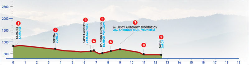
54 Kamares – Zaros
The village of Kamares on the southern edge of the Psiloriti mountain range is an important archaeological site. The Kamares Cave located higher up in the forest has unearthed a variety of significant Minoan pottery. The route is easy to follow and traverses the southern slope of the mountain range through small Cretan villages through dirt and paved roads. It is ideal for biking.
The E4 route from Kamares to Zaros
From Kamares (1), we follow the asphalt-paved, slightly uphill road eastwards; after 2 km, the village of Vorizia comes into view. One of the many gorges of the southern part of Psiloritis opens out on our left.
We begin to descend until we get to the first houses of the village (2).
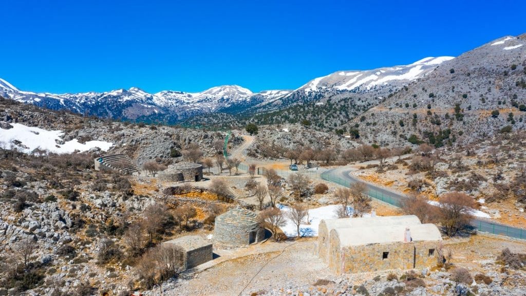
We follow the sign that reads “Varsamonero”, on the first road to the right; we continue on the cement road which passes through the village and reach the foot of the northern side of the low peak of Mesiskli. We then continue on an asphalt road, which passes through some olive groves on the slope; 3 km after Vorizia, we arrive at the ruined Monastery of Varsamonero (3). Vorizia is a historical village that was destroyed during World War II. There is now a small museum and some exquisite frescoes in the restored church of the monastery that is open to visitors.
From Varsamonero, we continue southwards on the unsurfaced road and then come to a water spring with a well. Then, we take the left branch at the first fork we encounter, for about 100 m (4). On the left side of the road, a shrine can then be seen; from this spot, we begin to walk down the low, bushy ridge, until a small dry-stone building. From here, we go down to a dry watercourse, which we cross and then begin to climb at the foot of the rocky slope. After a while, we reach a flat area where the ruins of the settlement of Nea Vorizia (5) can be seen between the slope and some rocks on our right-hand side.
The settlement was built in order to house the residents of Vorizia after the village was completely destroyed by the German forces, however, it was never inhabited. We continue along the dirt road which crosses the main road that connects Vorizia to Zaros (6) and then goes across to an uphill asphalt road which leads to the Monastery of Vrontisi (7); we arrive there after 1 km. Southwards, slightly before the courtyard of the monastery, a dirt road which goes towards the south-east begins, parallel to the boundary of the monastery’s garden. We follow it for 200 m and then turn left, eastwards, for another 100 m. At the next crossroads, after 100 m, we continue eastwards, straight on. We ignore a left side road 100 m further down and continue eastwards.
We keep on descending among olive groves, still on the main unsurfaced road, until we see a chapel with a characteristic pine tree on top of a low hill, on our left side. A few metres further down, we come to an asphalt road (8), which we take eastwards. After approximately 1,5 km, we arrive at Zaros (9).
| Path Length | 12.5 km |
|---|---|
| Hiking Duration | 3.5 hour |
| When to hike | Spring, Autumn, Summer, Winter |
| Path Region | Heraklion |