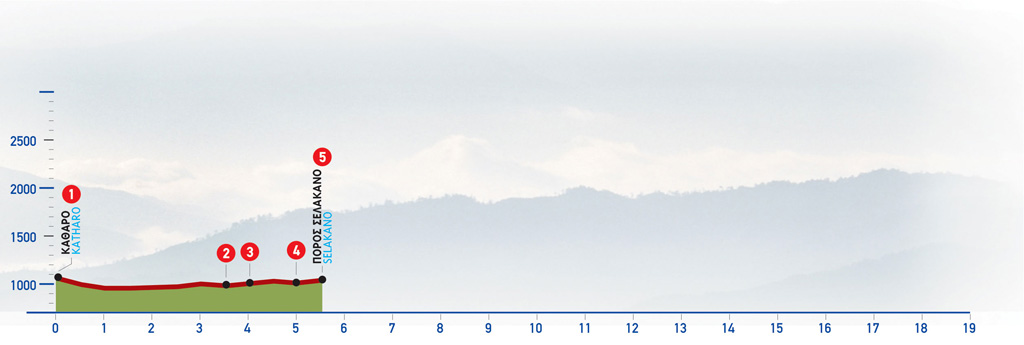
75 Katharo Plateau – Selakano
The plateau of Katharo (meaning “clean” in Greek), is located at an altitude of 1150 m, in Lassithi, in eastern Crete. It can be accessed by car, from the village of Kritsa in the east, and if you are following the E4 trail you can also walk from the village of Agios Georgios in the north. This is a wild and untamed area, where you will encounter mostly shepherds and goat herds, with magnificent views of the Lassithi plateau and there are also a few tavernas with excellent local cheeses that you must try. Historically, the area was an important agricultural region, but there were almost no permanent residents and access to water and electricity is still challenging. In the winter, the area is thick with snow and most people move to nearby villages. The land of the plateau is community-owned, and cultivation is only allowed to residents that must pay back a percentage of their earnings to Kritsa.
Also, this area has brought to light impressive paleontological findings from the Ice Age. Excavations in the area have unearthed fossils and bones that indicate the presence of nano-elephants and nano-hippos, that probably had to “shrink” in size to survive.
The route from Katharo Plateau to Selakano Forest
From Katharo (1), we follow the dirt road which goes along the foot of the eastern slope of the plateau, in an easterly direction.
The main unsurfaced road which we follow now takes a southerly course. It initially passes through a cultivated area and small clusters of farmhouses, as well as a few isolated buildings; later on, uncultivated land dominates the scenery.
After about 4 km, the Katharo Plateau is now behind us. We come to a left-hand side road (2) which we ignore and continue south-west, with a green slope on our right.
We carry on downhill on the main dirt road, which skirts around a characteristic rocky sandstone hill on its eastern side, and 500 m after the crossroads we come to a small chapel (3).
Approximately 900 m after the chapel, we cross a small stream, at a spot where there is a right-hand branch off the unsurfaced road (4) which we ignore and continue southwards for 750 m, into a pine-clad area.
Soon, we see a branch of the dirt road taking off diagonally on our right-hand side (5), almost parallel to the dirt road. This is where a vague path that leads to Mathokotsana and Selakano begins.
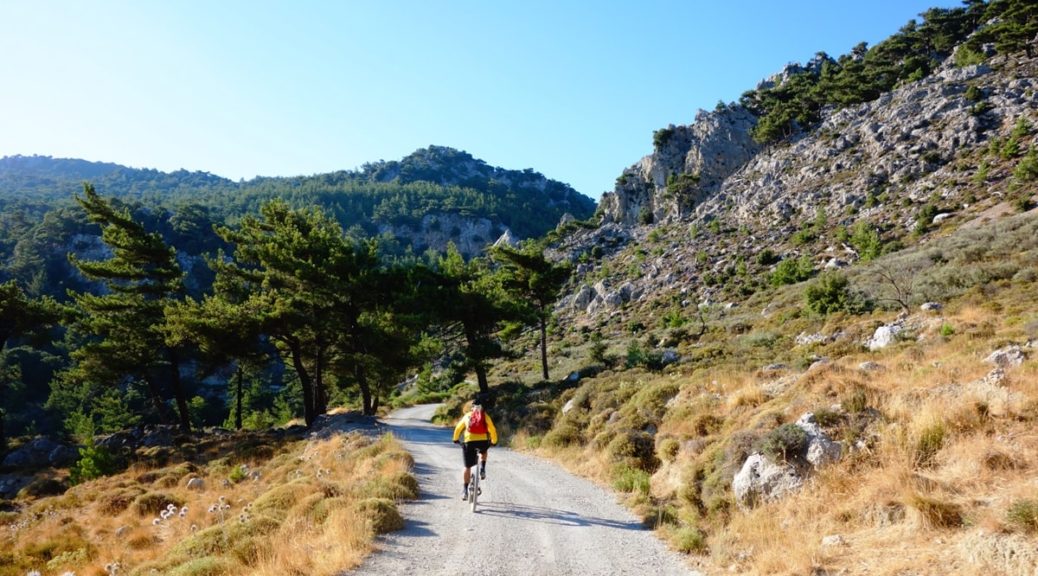
The route is also suitable for biking.
| Path Length | 6 km |
|---|---|
| Hiking Duration | 1.5 hour |
| When to hike | Spring, Autumn, Summer, Winter |
| Path Region | Lassithi |