06 Agios Ioannis – Palaiochora
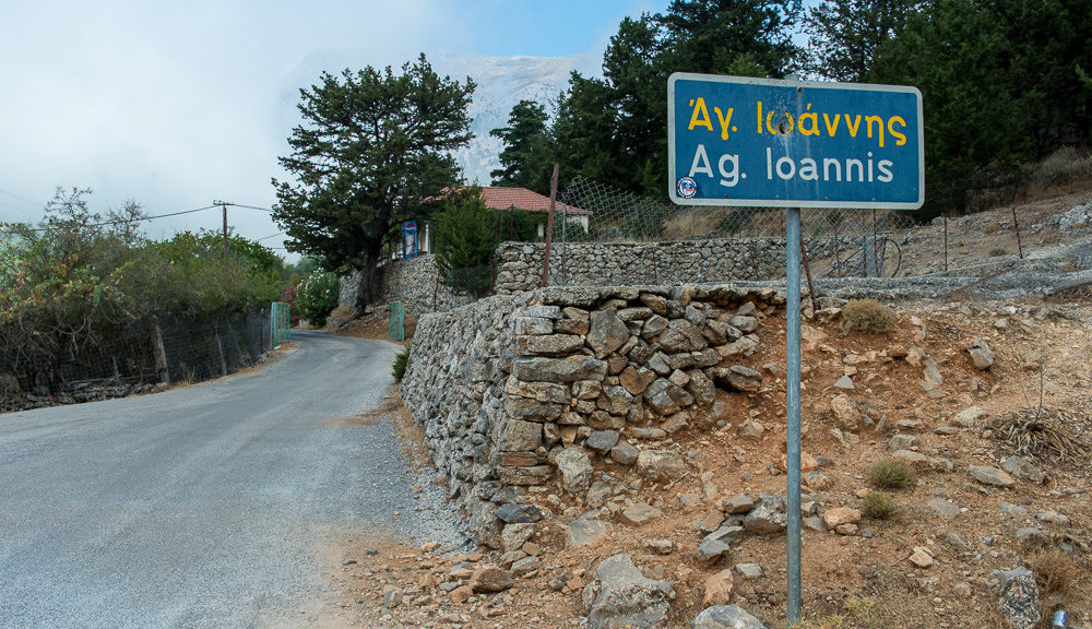
The chapel of Agios Ioannis is the starting point for this part of the E4 hiking trail on Crete island. Located on the southwest point of Crete, it can be reached by car or foot; the distance from Palaiochora is 13 km.
While it is relatively close to one of the most famous beaches of the island, Elafonissi, (a bay where Kedrodasos Beach is located), the narrow and windy roads make it hard to explore in a short period of time. So if you are driving, estimate a bit longer and make sure you fill-up with gas every chance you get.
Palaiochora, is a small peninsula, with 11 km of coastline only 77 km from Chania. Another E4 route that travels east through Sougia, Agia Roumeli, Loutro, and Chora Sfakion begins here. Due to the inaccessible and challenging nature of this part of the island, you might want to complete only short parts of the trails.
From Palaiochora, ferries departing to Gavdos island and the nearby coastal towns are also available.
The E4 route from Agios Ioannis to Palaiochora
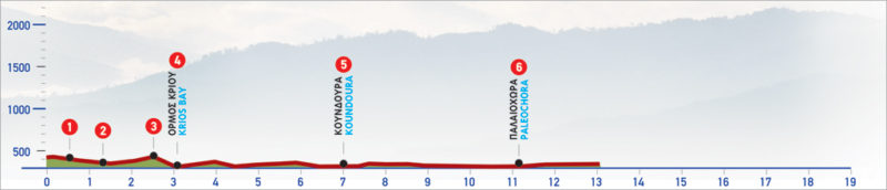
From Agios Ioannis (1), we follow the slope to the south, constantly having visual contact with Elafonissi. As soon as we turn south-east, leaving the chapel behind us, a little cove can be seen down below. After about 1200m we start to descend towards it. Reaching the cove (2), we see some scattered unfinished marble columns and some carved stones, evidence that the area was used as a quarry in antiquity.
From the cove, uphill to the east, we see a small saddle between some distinctive rocks, where the now easy to discern path leads us. Having walked up to the saddle of Cape Krios (3), we see a beach stretching out ahead of us. This is where a small gorge ends and the footpath ends up at the beach (4) of Krios. We walk along the beach and, having crossed the mouth of the stream, we continue on the beach road for about 450 m parallel to the coastline. Then, we continue inland for 250 m and turn right on the main road, which we follow and pass through a sparsely built area with greenhouses.
In approximately 4 km, we reach the small peninsula of Koundoura (5), with clusters of cedars and a small cove of the same name. From this point, we continue for another 4 km, keeping visual contact with the Libyan Sea below us or passing by beautiful small beaches, until we arrive at Palaiochora (6).
| Path Length | 13 km |
|---|---|
| Hiking Duration | 3 hour |
| When to hike | Spring, Autumn, Summer |
| Path Region | Chania |