80 Thripti – Kavoussi
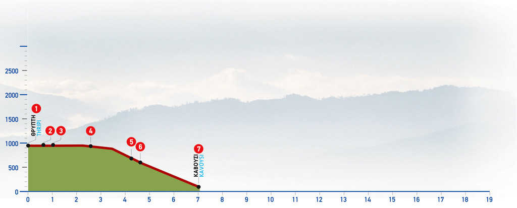
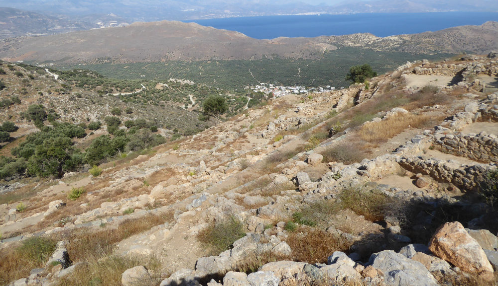
Τhripti is a small and mountainous village in Eastern Crete, on the path of the E4 walking trail, with a highest altitude of 1475 m in the peak of Afentis. The Thripti to Kavoussi route follows a northern direction towards Mirabello Bay. Kavoussi is a historic village with a steady population of about 600 people.
The route from Thripti to Kavousi
Starting from the Thripti settlement (1) we walk northwards, on the road that passes through the clusters of houses, from the central area of the village.
After 600 m, at its northernmost point, on the right-hand side of a characteristic evergreen oak (2), we go down a few steps that lead us to a dirt road, which we follow for approximately 400 m. We continue straight northwards, just past where the dirt roads cross (3).
We continue on the main unsurfaced road for 1.600 m; at a crossroads with a characteristic left bend, we come to a clear path (4) on our right side, which descends along a small valley on the way to Kavoussi village.
We follow the distinct downhill path, cross a small stream and walk along its left bank until we reach a characteristic rock, where we can enjoy the beautiful view of the whole area of Kavoussi before us.
The path continues to snake down the slope, initially running along a low ridge. It then comes upon a dirt road (5), at the foot of a large rock, and continues on the slope of a small valley with terraces, olive trees and scattered cypresses. Next, it goes through a clump of oaks with a water spring, (6) passes beside a ruined chapel, draws near a dirt road and then continues northwards, next to a few characteristic rocks.
The path continues, crossing a cement water channel and then another dirt road until it reaches a small stream and goes along its western bank. With the dirt road behind us, the path continues parallel to the stream, up to a point with eucalyptus trees that can be seen next to a dirt road.
We follow the dirt road for approximately 50 m and then turn right on a path that runs parallel to a cement water channel. Having crossed a dirt road, we pass next to an old water reservoir and reach the first houses of Kavoussi (7).
We pass through the village until we reach the square; from there on, the road leads us to the main road that runs through Kavoussi and connects Agios Nikolaos to Sitia.
| Path Length | 7.5 km |
|---|---|
| Hiking Duration | 2 hour |
| When to hike | Spring, Autumn, Summer, Winter |
| Path Region |