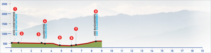
42 Agios Konstantinos – Ano Valsamonero
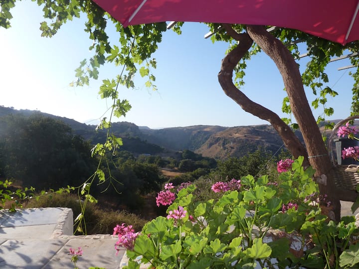
A pleasant and relatively easy part of the E4 trail on Crete island, this route starts at the village of Agios Konstantinos, situated only 20 km from Rethymno. The path is mainly on dirt and paved roads and crosses through neighbouring villages before reaching Ano Valsamonero. From here you can carry on towards Armeni where the Late Minoan Cemetery ruins can be found.
The E4 route from Agios Konstantinos to Ano Valsamonero
At the southern exit (1) of Agios Konstantinos, on the eastern side of the asphalt road, a downhill dirt road begins, which after passing along the northern slope of a smooth hill, follows the western bank of a ravine.
Approximately 700 m after Agios Konstantinos, at a spot where a brick building can be seen on our right, we cross the ravine (2) and immediately after come to a crossroads.
We take the left (northern) branch and after about 250 m, we reach a small bridge over a ravine with plane trees. We cross the bridge and then ignore two consecutive left branches of the slightly uphill dirt road. Next, we continue for 700 m until the following crossroads, the left branch of which we follow for approximately 350 m. Continuing straight on, we ignore first a left and then a right branch of the unsurfaced road. After 750 m on the main dirt road, we come to an asphalt road (3) and the first houses of the Kaloniktis village.
Following the main road for 300 m, we arrive at the village square, where the old Primary School is located. From the north-western corner (4) of the schoolyard, we continue southwards. We then pass by a cemetery on our left, continue straight on for 300 m, in a south-easterly direction, passing through olive groves, and come to a fork with three branches. Here we will take the right-hand one. We descend parallel to a small stream until a valley where there is a ravine with plane trees (5).
We walk in the stream bed for about 500 m and then come to an unsurfaced road which crosses it. We pass onto the right, southern bank, following the dirt road parallel to the stream for approximately 350 m. We then take the left-hand, northern route, cross the ravine (6) and go up the slope in a northerly direction, until the top of the small stream, to a spot with many plane trees, where there is a water spring (7). At the south-western slope of the big ravine which we crossed earlier, the ruins of a medieval tower can be seen by now. From the spring, we follow the main dirt road in a north-easterly direction, among olive groves. We continue straight on, ignoring any branches of the road. After 1,5 km in total from the spring, we arrive at the village of Ano Valsamonero (8).
| Path Length | 8.5 km |
|---|---|
| Hiking Duration | 3 hour |
| When to hike | Spring, Autumn, Summer, Winter |
| Path Region | Rethymno |